Burela de Cabo night lights from space
Night Light of Burela de Cabo (Galicia) from space (Spain) Src. Average luminocity for 10x10km area is 8.5212% and for 50x50km: 1.4995%.
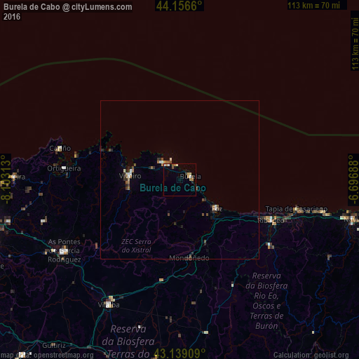
Analysis of Burela de Cabo night lights 2016
Square area 10x10 km:
 1.06%
1.06%90-99
1.36%80-89
0.61%70-79
1.67%60-69
1.97%50-59
0.76%40-49
0.76%30-39
0.91%20-29
0.61%10-19
1.21%0-9
89.09%Square area 50x50 km:
0.15%90-99
0.17%80-89
0.09%70-79
0.1%60-69
0.27%50-59
0.2%40-49
0.35%30-39
0.19%20-29
0.51%10-19
0.36%0-9
97.6%Clear (daylight) street map image can be seen on geolist.org.
Map coordinates:
44° 9' 23.8" North, 8° 6' 11.3" West
43° 39' 0" North, 7° 24' 0" West
43° 8' 20.7" North, 6° 41' 48.8" West
Some cities around Burela de Cabo sort by population:
• Viveiro
15.6 km =9.7 mi,  275°
275°
• Vilalba
45.2 km =28.1 mi,  210°
210°
• As Pontes de García Rodríguez
42.5 km =26.4 mi,  238°
238°
• Foz
14.8 km =9.2 mi,  127°
127°
• Ribadeo
31.5 km =19.6 mi,  113°
113°
• Santa Marta de Ortigueira
36.4 km =22.6 mi, 275°
• Cedeira
52.9 km =32.9 mi,  271°
271°
• Castro de Rei
49.1 km =30.5 mi,  180°
180°
3127476 (p: 8,338)
Sources (retrieved 2019-11-25):
» Earth at Night: Flat Maps 2012, 2016