Coslada night lights from space
Night Light of Coslada (Madrid) from space (Spain) Src. Average luminocity for 10x10km area is 87.7007% and for 50x50km: 51.4839%.
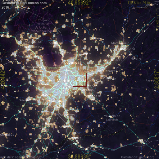
Analysis of Coslada night lights 2016
Square area 10x10 km:
 29.25%
90-99
30.27%80-89
10.03%70-79
15.31%60-69
10.03%50-59
4.42%40-49
0.68%30-39
0%20-29
0%10-19
0%0-9
0%Square area 50x50 km:
15.08%90-99
12.8%80-89
4.87%70-79
6.02%60-69
5.09%50-59
4.71%40-49
4.97%30-39
6.31%20-29
10.5%10-19
13.63%0-9
16.03%Clear (daylight) street map image can be seen on geolist.org.
Map coordinates:
40° 57' 24.9" North, 4° 15' 51.9" West
40° 25' 25.6" North, 3° 33' 40.6" West
39° 53' 11" North, 2° 51' 29.4" West
Some cities around Coslada sort by population:
• Ciudad Lineal
8 km =5 mi,  287°
287°
• San Blas-Canillejas
4.9 km =3 mi, 290°
• Moratalaz
7.7 km =4.8 mi,  256°
256°
• Vicálvaro
4.2 km =2.6 mi,  231°
231°
• Villa de Vallecas
7.2 km =4.5 mi,  208°
208°
• Barajas de Madrid
5.7 km =3.5 mi,  345°
345°
• San Fernando de Henares
2.4 km =1.5 mi,  89°
89°
• Mejorada del Campo
7.5 km =4.7 mi,  117°
117°
3124408 (p: 90,280)
Sources (retrieved 2019-11-25):
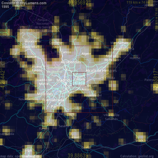
» NASA, Earths city lights 1995
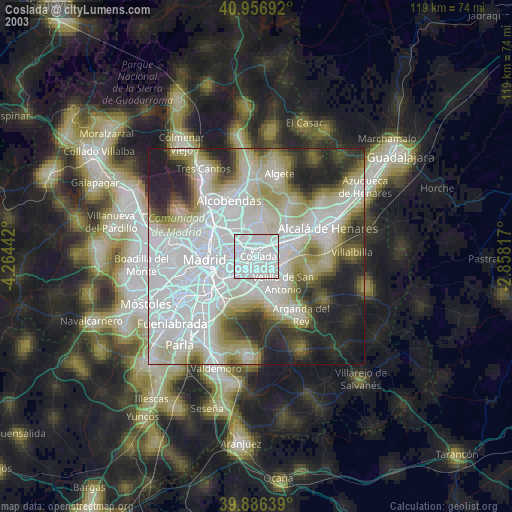
» NASA city lights 2003
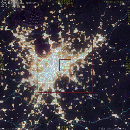
» Earth at Night: Flat Maps 2012, 2016