Montgat night lights from space
Night Light of Montgat (Catalonia) from space (Spain) Src. Average luminocity for 10x10km area is 60.398% and for 50x50km: 41.8838%.
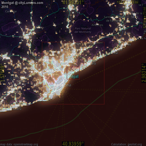
Analysis of Montgat night lights 2016
Square area 10x10 km:
 17.01%
90-99
14.29%80-89
6.29%70-79
4.25%60-69
8.5%50-59
11.05%40-49
7.31%30-39
4.25%20-29
13.1%10-19
10.2%0-9
3.74%Square area 50x50 km:
11.2%90-99
10.19%80-89
4.13%70-79
5.24%60-69
7.19%50-59
4.89%40-49
3.28%30-39
3.48%20-29
7.02%10-19
9.48%0-9
33.9%Clear (daylight) street map image can be seen on geolist.org.
Map coordinates:
41° 59' 35.9" North, 1° 34' 36.8" East
41° 28' 6.9" North, 2° 16' 48" East
40° 56' 22.5" North, 2° 58' 59.3" East
Some cities around Montgat sort by population:
• Badalona
3.4 km =2.1 mi,  232°
232°
• Santa Coloma de Gramenet
6.3 km =3.9 mi,  252°
252°
• Llefià
6.1 km =3.8 mi,  236°
236°
• Sant Adrià de Besòs
6.6 km =4.1 mi, 230°
• El Masnou
3.5 km =2.2 mi,  68°
68°
• Alella
3.1 km =1.9 mi,  23°
23°
• Tiana
1.8 km =1.1 mi,  324°
324°
• Teià
4.8 km =3 mi,  46°
46°
3116474 (p: 10,270)
Sources (retrieved 2019-11-25):
» Earth at Night: Flat Maps 2012, 2016