Ḩawsh ‘Īsá night lights from space
Night Light of Ḩawsh ‘Īsá (Beheira) from space (Egypt) Src. Average luminocity for 10x10km area is 71% and for 50x50km: 59.5065%.
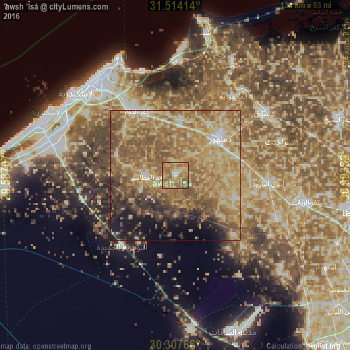
Analysis of Ḩawsh ‘Īsá night lights 2016
Square area 10x10 km:
 3.32%
3.32%90-99
4.55%80-89
20.45%70-79
19.93%60-69
35.31%50-59
15.73%40-49
0.7%30-39
0%20-29
0%10-19
0%0-9
0%Square area 50x50 km:
2.59%90-99
6.46%80-89
15.54%70-79
14.34%60-69
17.41%50-59
15.31%40-49
7.37%30-39
5.4%20-29
4.16%10-19
6.75%0-9
4.67%Clear (daylight) street map image can be seen on geolist.org.
Map coordinates:
31° 30' 50.9" North, 29° 35' 13.5" East
30° 54' 46.1" North, 30° 17' 24.7" East
30° 18' 27.6" North, 30° 59' 36" East
Some cities around Ḩawsh ‘Īsá sort by population:
• Kafr ad Dawwār
28.9 km =18 mi,  328°
328°
• Damanhūr
21.7 km =13.5 mi,  51°
51°
• Idkū
43.9 km =27.3 mi,  0°
0°
• Disūq
41.9 km =26 mi, 54°
• Fuwwah
40.7 km =25.3 mi,  37°
37°
• Abū al Maţāmīr
11.1 km =6.9 mi,  268°
268°
• Ad Dilinjāt
25.2 km =15.7 mi,  111°
111°
• Kawm Ḩamādah
42.6 km =26.5 mi, 113°
356000 (p: 85,352)
Sources (retrieved 2019-11-25):
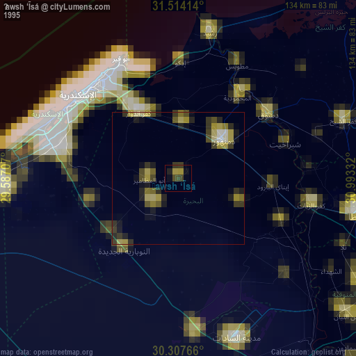
» NASA, Earths city lights 1995
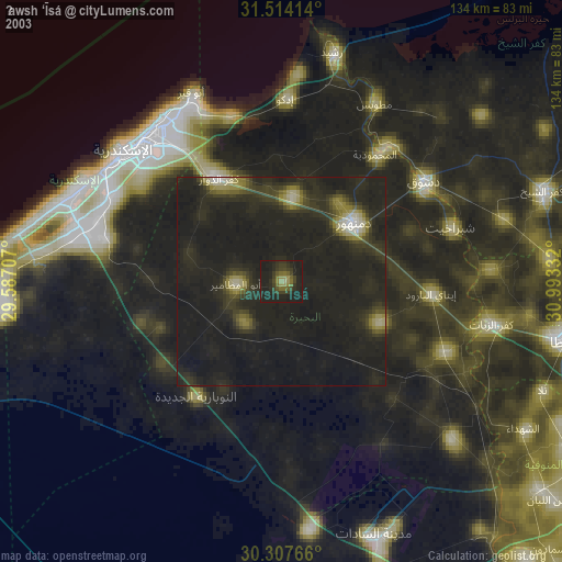
» NASA city lights 2003
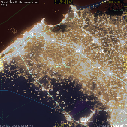
» Earth at Night: Flat Maps 2012, 2016