Al Fashn night lights from space
Night Light of Al Fashn (Beni Suweif) from space (Egypt) Src. Average luminocity for 10x10km area is 57.7311% and for 50x50km: 32.7003%.
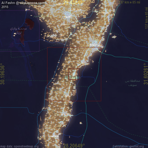
Analysis of Al Fashn night lights 2016
Square area 10x10 km:
 6.44%
6.44%90-99
7.77%80-89
7.58%70-79
7.58%60-69
11.36%50-59
25.95%40-49
14.58%30-39
1.14%20-29
9.66%10-19
7.95%0-9
0%Square area 50x50 km:
2.97%90-99
5.09%80-89
6.01%70-79
5.63%60-69
6.97%50-59
8.27%40-49
6.91%30-39
2.77%20-29
4.4%10-19
7.58%0-9
43.41%Clear (daylight) street map image can be seen on geolist.org.
Map coordinates:
29° 26' 18.6" North, 30° 11' 46.9" East
28° 49' 27.5" North, 30° 53' 58.1" East
28° 12' 23.4" North, 31° 36' 9.4" East
Some cities around Al Fashn sort by population:
• Banī Suwayf
33.9 km =21.1 mi,  34°
34°
• Samālūţ
59.9 km =37.2 mi,  197°
197°
• Būsh
42.3 km =26.3 mi, 31°
• Banī Mazār
36.9 km =22.9 mi, 195°
• Ibshawāy
63.1 km =39.2 mi,  340°
340°
• Iţsā
47.2 km =29.3 mi,  346°
346°
• Maţāy
46.6 km =29 mi,  194°
194°
• Sumusţā as Sulţānī
11.3 km =7 mi,  334°
334°
361329 (p: 63,793)
Sources (retrieved 2019-11-25):
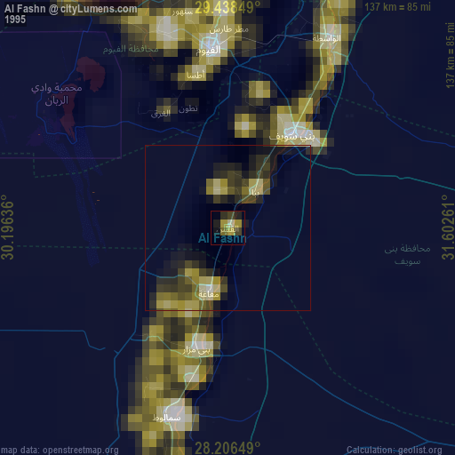
» NASA, Earths city lights 1995
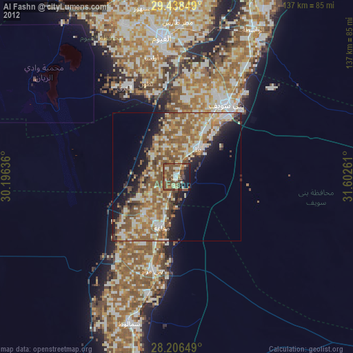
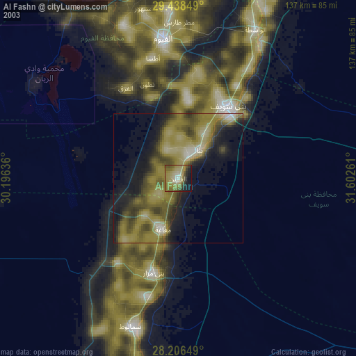
» NASA city lights 2003
» Earth at Night: Flat Maps 2012, 2016