Ain Sukhna night lights from space
Night Light of Ain Sukhna (Suez) from space (Egypt) Src. Average luminocity for 10x10km area is 41.3909% and for 50x50km: 8.4379%.
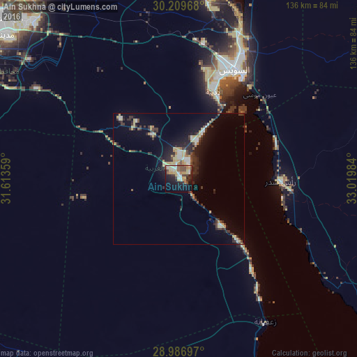
Analysis of Ain Sukhna night lights 2016
Square area 10x10 km:
 6.35%
6.35%90-99
6.15%80-89
7.34%70-79
7.74%60-69
4.56%50-59
2.58%40-49
8.73%30-39
5.95%20-29
10.32%10-19
24.21%0-9
16.07%Square area 50x50 km:
0.92%90-99
0.94%80-89
1.72%70-79
0.9%60-69
0.6%50-59
0.34%40-49
1.45%30-39
2.18%20-29
2.8%10-19
5.33%0-9
82.82%Clear (daylight) street map image can be seen on geolist.org.
Map coordinates:
30° 12' 34.8" North, 31° 36' 48.9" East
29° 36' 0.6" North, 32° 19' 0.2" East
28° 59' 13.1" North, 33° 1' 11.4" East
Some cities around Ain Sukhna sort by population:
• Suez
46.2 km =28.7 mi,  25°
25°
• Ismailia
111.7 km =69.4 mi,  357°
357°
• Ḩalwān
101.7 km =63.2 mi,  285°
285°
• New Cairo
94.6 km =58.8 mi,  300°
300°
• Al Ḩawāmidīyah
108.2 km =67.2 mi, 287°
• Aş Şaff
100.2 km =62.3 mi,  267°
267°
• Al Wāsiţah
111.5 km =69.3 mi,  254°
254°
• Al ‘Ayyāţ
102.4 km =63.6 mi, 271°
7521348 (p: 45,552)
Sources (retrieved 2019-11-25):
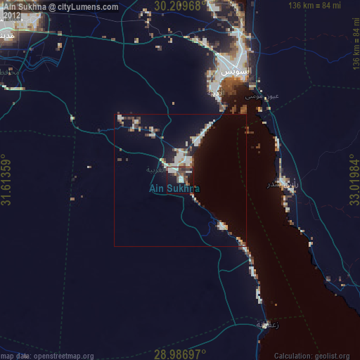
» Earth at Night: Flat Maps 2012, 2016