Al Wāsiţah night lights from space
Night Light of Al Wāsiţah (Faiyum) from space (Egypt) Src. Average luminocity for 10x10km area is 79.7841% and for 50x50km: 39.9929%.
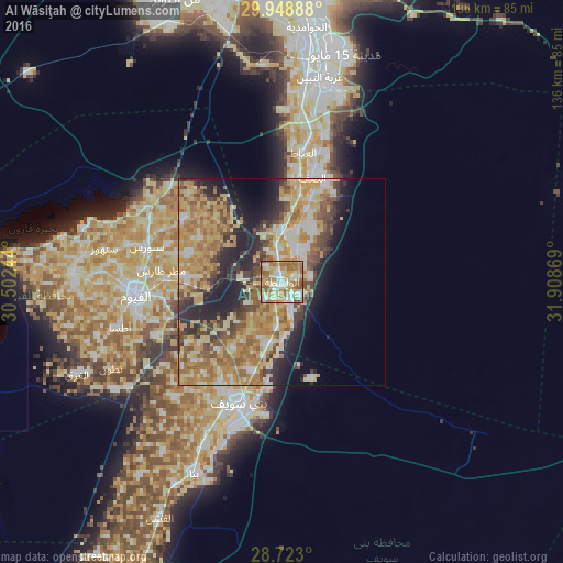
Analysis of Al Wāsiţah night lights 2016
Square area 10x10 km:
 15.72%
90-99
17.99%80-89
19.13%70-79
16.67%60-69
18.94%50-59
10.61%40-49
0.76%30-39
0.19%20-29
0%10-19
0%0-9
0%Square area 50x50 km:
3.94%90-99
5.69%80-89
9.22%70-79
9.42%60-69
8.63%50-59
5.58%40-49
4.71%30-39
4.38%20-29
7.89%10-19
8.97%0-9
31.58%Clear (daylight) street map image can be seen on geolist.org.
Map coordinates:
29° 56' 56" North, 30° 30' 8.8" East
29° 20' 16" North, 31° 12' 20" East
28° 43' 22.8" North, 31° 54' 31.3" East
Some cities around Al Wāsiţah sort by population:
• Al Fayyūm
35.4 km =22 mi,  264°
264°
• Banī Suwayf
31.1 km =19.3 mi,  199°
199°
• Būsh
22.4 km =13.9 mi, 199°
• Ibshawāy
50.9 km =31.6 mi,  272°
272°
• Ţāmiyah
28.2 km =17.5 mi,  303°
303°
• Iţsā
41.9 km =26 mi,  254°
254°
• Aş Şaff
26.3 km =16.3 mi,  16°
16°
• Al ‘Ayyāţ
31.7 km =19.7 mi,  9°
9°
360464 (p: 37,453)
Sources (retrieved 2019-11-25):
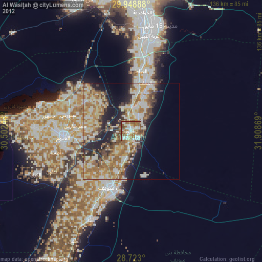
» Earth at Night: Flat Maps 2012, 2016