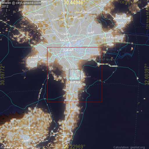
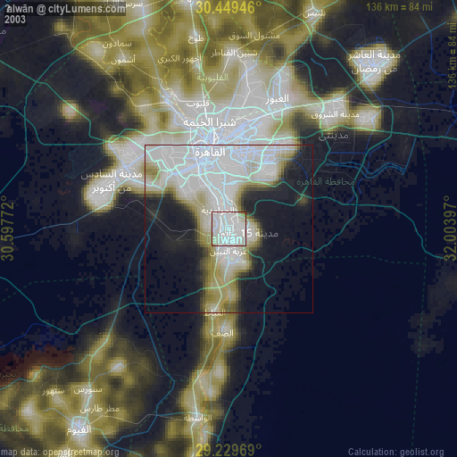
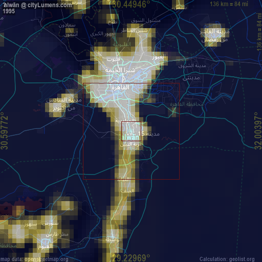
Ḩalwān night lights from space
Night Light of Ḩalwān (Cairo) from space (Egypt) Src. Average luminocity for 10x10km area is 97.6667% and for 50x50km: 53.6823%.
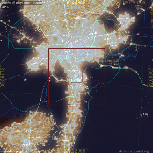
Analysis of Ḩalwān night lights 2016
Square area 10x10 km:
 52.18%
90-99
41.27%80-89
5.36%70-79
0.79%60-69
0.4%50-59
0%40-49
0%30-39
0%20-29
0%10-19
0%0-9
0%Square area 50x50 km:
24.1%90-99
12.58%80-89
7.92%70-79
3.14%60-69
1.75%50-59
2.37%40-49
4.28%30-39
4.53%20-29
5.13%10-19
6.02%0-9
28.2%Clear (daylight) street map image can be seen on geolist.org.
Map coordinates:
30° 26' 58.1" North, 30° 35' 51.8" East
29° 50' 29.2" North, 31° 18' 3" East
29° 13' 46.9" North, 32° 0' 14.3" East
Some cities around Ḩalwān sort by population:
• Cairo
25.1 km =15.6 mi,  348°
348°
• Giza
20.7 km =12.9 mi,  334°
334°
• New Cairo
26.6 km =16.5 mi,  37°
37°
• Al Ḩawāmidīyah
8.2 km =5.1 mi,  323°
323°
• Awsīm
35.1 km =21.8 mi, 333°
• Madīnat Sittah Uktūbar
24.4 km =15.2 mi,  263°
263°
• Aş Şaff
30.8 km =19.1 mi,  183°
183°
• Al ‘Ayyāţ
25 km =15.5 mi,  189°
189°
355795 (p: 230,000)
Sources (retrieved 2019-11-25):
» NASA, Earths city lights 1995
» NASA city lights 2003
» Earth at Night: Flat Maps 2012, 2016