Remchi night lights from space
Night Light of Remchi (Tlemcen) from space (Algeria) Src. Average luminocity for 10x10km area is 18.0455% and for 50x50km: 9.4885%.
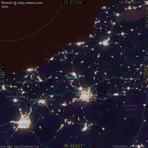
Analysis of Remchi night lights 2016
Square area 10x10 km:
 1.22%
1.22%90-99
2.1%80-89
1.92%70-79
3.5%60-69
3.15%50-59
2.1%40-49
1.75%30-39
3.32%20-29
0.17%10-19
17.13%0-9
63.64%Square area 50x50 km:
0.78%90-99
1.19%80-89
1.35%70-79
1.44%60-69
1.56%50-59
0.91%40-49
1.27%30-39
1.96%20-29
2.06%10-19
5.17%0-9
82.3%Clear (daylight) street map image can be seen on geolist.org.
Map coordinates:
35° 38' 7.7" North, 2° 8' 12.3" West
35° 3' 43.1" North, 1° 26' 1" West
34° 29' 3.9" North, 0° 43' 49.8" West
Some cities around Remchi sort by population:
• Tlemcen
23.1 km =14.4 mi,  152°
152°
• Mansoûra
23.9 km =14.9 mi,  158°
158°
• Beni Saf
27 km =16.8 mi,  9°
9°
• Hennaya
13.7 km =8.5 mi, 154°
• Chetouane
20.1 km =12.5 mi,  141°
141°
• Sidi Abdelli
27 km =16.8 mi,  88°
88°
• Bensekrane
19.1 km =11.9 mi, 85°
• Beni Mester
21.3 km =13.2 mi,  177°
177°
2483649 (p: 51,224)
Sources (retrieved 2019-11-25):
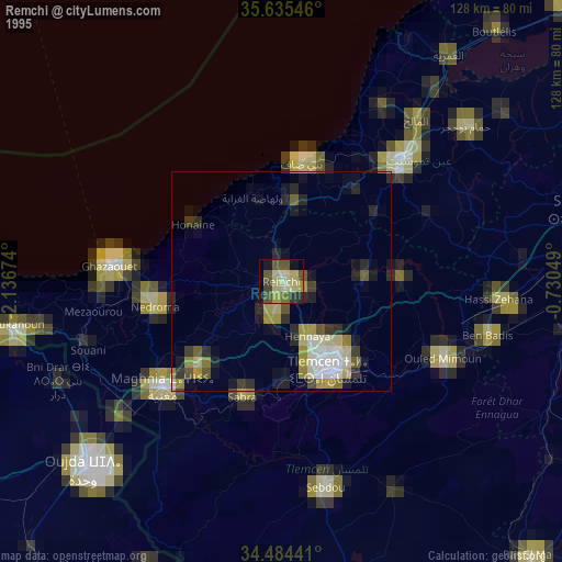
» NASA, Earths city lights 1995
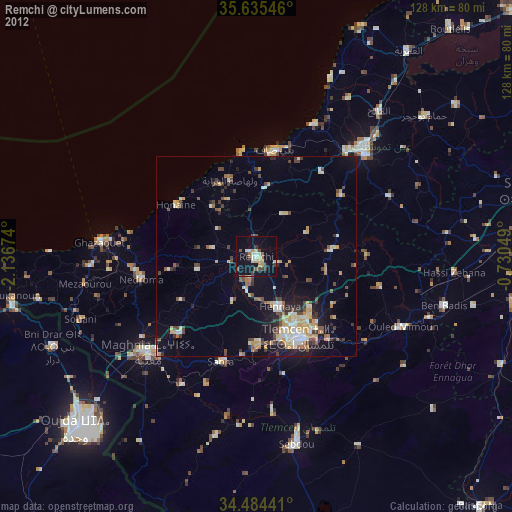
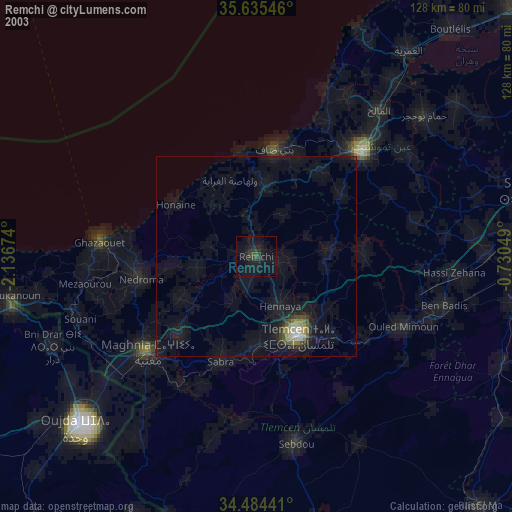
» NASA city lights 2003
» Earth at Night: Flat Maps 2012, 2016