Guelma night lights from space
Night Light of Guelma from space (Algeria) Src. Average luminocity for 10x10km area is 47.2436% and for 50x50km: 6.2422%.
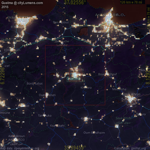
Analysis of Guelma night lights 2016
Square area 10x10 km:
 8.24%
8.24%90-99
9.71%80-89
5.86%70-79
4.58%60-69
4.4%50-59
3.11%40-49
8.79%30-39
14.29%20-29
18.86%10-19
21.25%0-9
0.92%Square area 50x50 km:
0.52%90-99
1.09%80-89
0.91%70-79
0.63%60-69
0.59%50-59
0.49%40-49
0.83%30-39
1.53%20-29
1.28%10-19
3.79%0-9
88.33%Clear (daylight) street map image can be seen on geolist.org.
Map coordinates:
37° 1' 32" North, 6° 43' 22.7" East
36° 27' 43.7" North, 7° 25' 33.9" East
35° 53' 40.5" North, 8° 7' 45.2" East
Some cities around Guelma sort by population:
• Azzaba
42.1 km =26.2 mi,  317°
317°
• Besbes
46.1 km =28.6 mi,  54°
54°
• Drean
38.1 km =23.7 mi, 49°
• Sedrata
38.3 km =23.8 mi,  165°
165°
• El Hadjar
47 km =29.2 mi,  36°
36°
• Héliopolis
4.8 km =3 mi,  17°
17°
• Boumahra Ahmed
7.9 km =4.9 mi,  93°
93°
• Berrahal
41.6 km =25.8 mi,  3°
3°
2495662 (p: 123,590)
Sources (retrieved 2019-11-25):
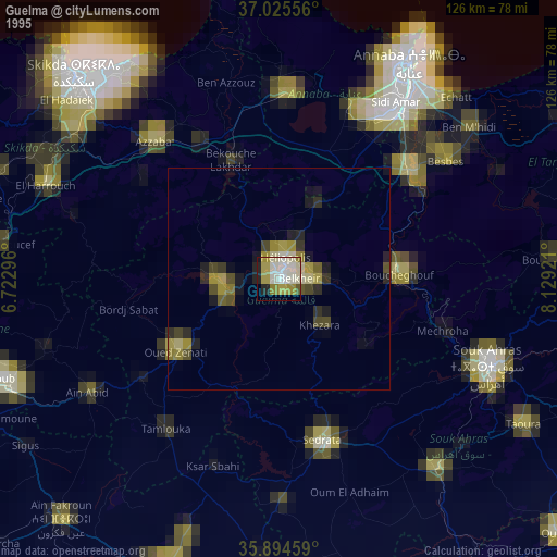
» NASA, Earths city lights 1995
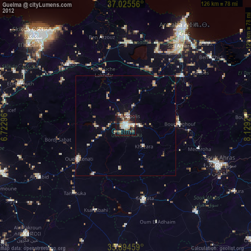
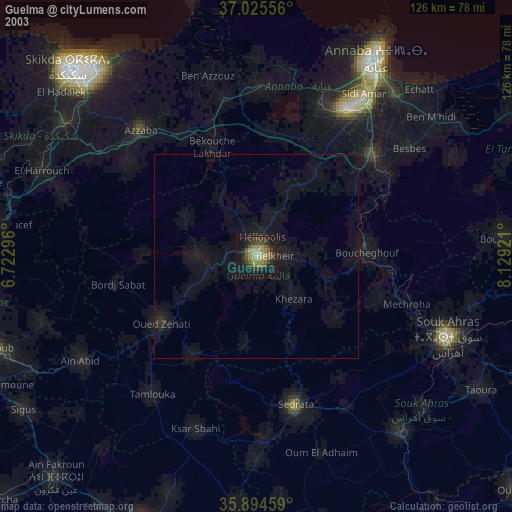
» NASA city lights 2003
» Earth at Night: Flat Maps 2012, 2016