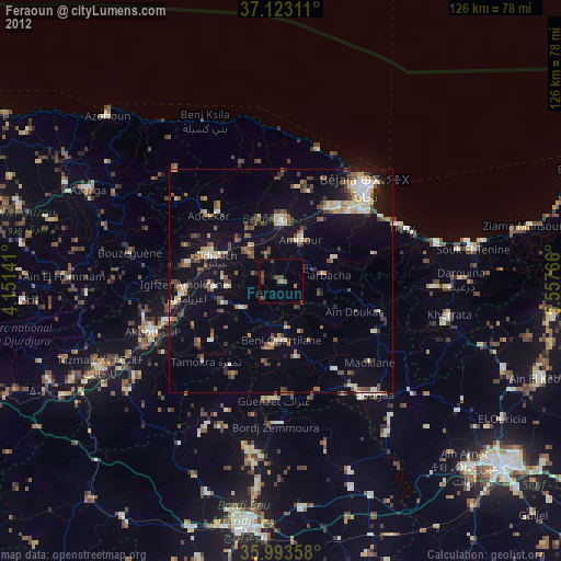
Feraoun night lights from space
Night Light of Feraoun (Béjaïa) from space (Algeria) Src. Average luminocity for 10x10km area is 7.0385% and for 50x50km: 13.4043%.
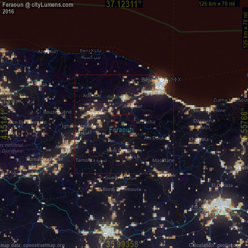
Analysis of Feraoun night lights 2016
Square area 10x10 km:
100  0.18%
0.18%
90-99 0%
80-89 0.37%
70-79 1.1%
60-69 0%
50-59 0.37%
40-49 2.2%
30-39 4.95%
20-29 2.01%
10-19 0.55%
0-9 88.28%
0.18%90-99
0%80-89
0.37%70-79
1.1%60-69
0%50-59
0.37%40-49
2.2%30-39
4.95%20-29
2.01%10-19
0.55%0-9
88.28%Square area 50x50 km:
100 0.69%
90-99 1.7%
80-89 1.32%
70-79 2.39%
60-69 1.23%
50-59 1.53%
40-49 2.43%
30-39 3.12%
20-29 3.31%
10-19 12.95%
0-9 69.33%
0.69%90-99
1.7%80-89
1.32%70-79
2.39%60-69
1.23%50-59
1.53%40-49
2.43%30-39
3.12%20-29
3.31%10-19
12.95%0-9
69.33%Clear (daylight) street map image can be seen on geolist.org.
Map coordinates:
37° 7' 23.2" North, 4° 9' 5.1" East
36° 33' 37.5" North, 4° 51' 16.3" East
35° 59' 36.9" North, 5° 33' 27.6" East
Some cities around Feraoun sort by population:
• Bejaïa
29.9 km =18.6 mi,  43°
43°
• Akbou
30.8 km =19.1 mi,  248°
248°
• Barbacha
10 km =6.2 mi,  86°
86°
• el hed
12.3 km =7.6 mi,  324°
324°
• El Kseur
13.2 km =8.2 mi,  0°
0°
• Amizour
9.8 km =6.1 mi,  25°
25°
• Chemini
21.7 km =13.5 mi,  281°
281°
• Seddouk
15.1 km =9.4 mi,  264°
264°
2496573 (p: 21,700)
Sources (retrieved 2019-11-25):
» Earth at Night: Flat Maps 2012, 2016