San Pedro de Macorís night lights from space
Night Light of San Pedro de Macorís from space (Dominican Republic) Src. Average luminocity for 10x10km area is 49.25% and for 50x50km: 4.5926%.
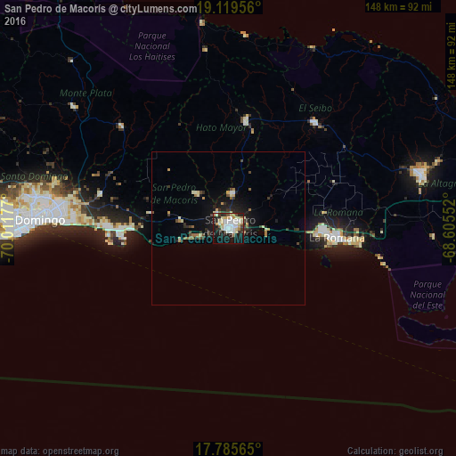

Analysis of San Pedro de Macorís night lights 2016
Square area 10x10 km:
 11.16%
90-99
14.05%80-89
8.47%70-79
5.17%60-69
2.07%50-59
3.51%40-49
1.86%30-39
5.37%20-29
14.05%10-19
27.89%0-9
6.4%Square area 50x50 km:
0.47%90-99
0.8%80-89
0.62%70-79
0.5%60-69
0.51%50-59
0.32%40-49
0.55%30-39
0.71%20-29
1.32%10-19
3.63%0-9
90.56%Clear (daylight) street map image can be seen on geolist.org.
Map coordinates:
19° 7' 10.4" North, 70° 0' 42.4" West
18° 27' 14" North, 69° 18' 31.1" West
17° 47' 8.3" North, 68° 36' 19.9" West
Some cities around San Pedro de Macorís sort by population:
• La Romana
35.5 km =22.1 mi,  94°
94°
• Boca Chica
30.7 km =19.1 mi,  269°
269°
• Hato Mayor del Rey
34.8 km =21.6 mi,  9°
9°
• Santa Cruz de El Seibo
44.8 km =27.8 mi,  39°
39°
• Bayaguana
47.7 km =29.6 mi,  313°
313°
• Quisqueya
15.4 km =9.6 mi,  317°
317°
• Guaymate
37.8 km =23.5 mi,  66°
66°
• Los Llanos
27.1 km =16.8 mi, 313°
3493032 (p: 217,899)
Sources (retrieved 2019-11-25):
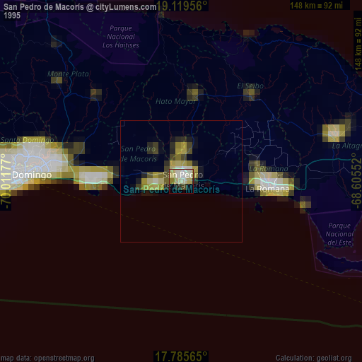
» NASA, Earths city lights 1995
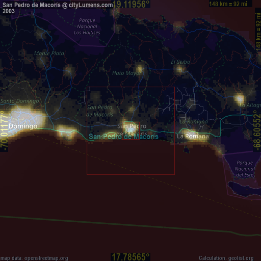
» NASA city lights 2003
» Earth at Night: Flat Maps 2012, 2016