Villa Francisca night lights from space
Night Light of Villa Francisca (Nacional) from space (Dominican Republic) Src. Average luminocity for 10x10km area is 83.1612% and for 50x50km: 25.7636%.
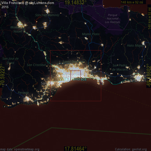
Analysis of Villa Francisca night lights 2016
Square area 10x10 km:
 44.42%
90-99
24.38%80-89
6.4%70-79
2.07%60-69
2.07%50-59
0.41%40-49
1.86%30-39
9.71%20-29
8.47%10-19
0.21%0-9
0%Square area 50x50 km:
6.22%90-99
5.92%80-89
2.83%70-79
2.58%60-69
3.54%50-59
1.78%40-49
3.09%30-39
3.99%20-29
6.56%10-19
9.36%0-9
54.13%Clear (daylight) street map image can be seen on geolist.org.
Map coordinates:
19° 8' 54" North, 70° 35' 32.2" West
18° 28' 58" North, 69° 53' 20.9" West
17° 48' 52.7" North, 69° 11' 9.7" West
Some cities around Villa Francisca sort by population:
• Santo Domingo
1.3 km =0.8 mi,  195°
195°
• Santo Domingo Este
3.4 km =2.1 mi,  79°
79°
• Ciudad Nueva
1.8 km =1.1 mi,  194°
194°
• Cristo Rey
5 km =3.1 mi,  292°
292°
• San Carlos
1.1 km =0.7 mi,  273°
273°
• La Julia
5 km =3.1 mi,  248°
248°
• La Agustina
5 km =3.1 mi, 292°
• Ensanche Luperón
2.2 km =1.4 mi,  329°
329°
3491941 (p: 50,185)
Sources (retrieved 2019-11-25):
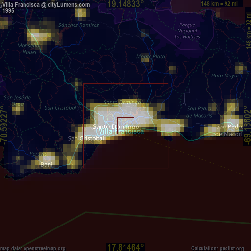
» NASA, Earths city lights 1995
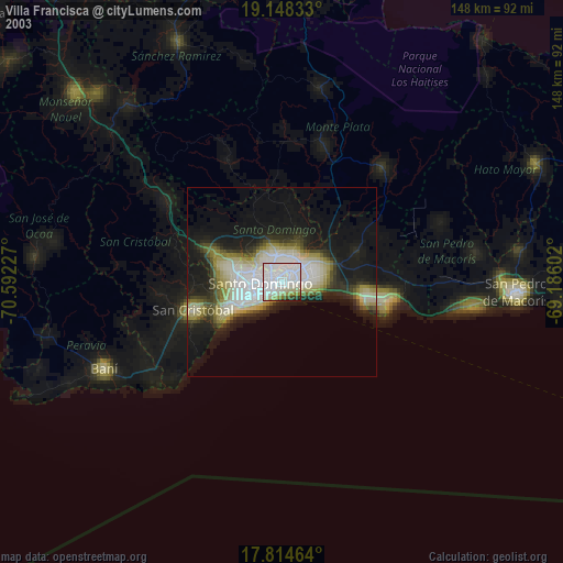
» NASA city lights 2003
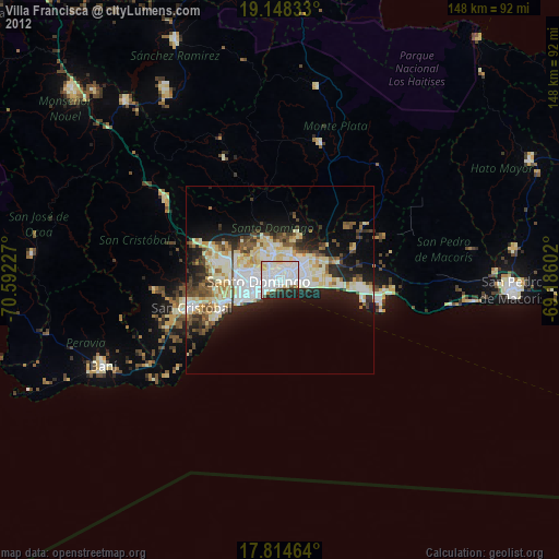
» Earth at Night: Flat Maps 2012, 2016