Wedding night lights from space
Night Light of Wedding (Berlin) from space (Germany) Src. Average luminocity for 10x10km area is 98.4471% and for 50x50km: 37.463%.
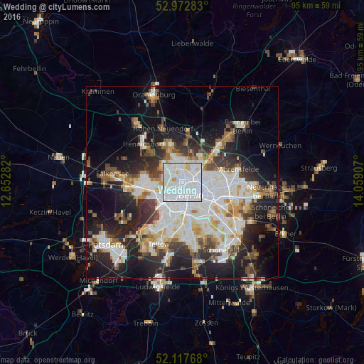
Analysis of Wedding night lights 2016
Square area 10x10 km:
 68.39%
90-99
26.46%80-89
4.23%70-79
0.66%60-69
0.26%50-59
0%40-49
0%30-39
0%20-29
0%10-19
0%0-9
0%Square area 50x50 km:
10.79%90-99
9.31%80-89
3.63%70-79
2.94%60-69
3.18%50-59
3.47%40-49
4%30-39
4.47%20-29
8.73%10-19
15.68%0-9
33.81%Clear (daylight) street map image can be seen on geolist.org.
Map coordinates:
52° 58' 22.2" North, 12° 39' 10.2" East
52° 32' 50.4" North, 13° 21' 21.4" East
52° 7' 3.6" North, 14° 3' 32.7" East
Some cities around Wedding sort by population:
• Berlin
4.5 km =2.8 mi,  124°
124°
• Gesundbrunnen
2.4 km =1.5 mi,  82°
82°
• Reinickendorf
2.6 km =1.6 mi,  324°
324°
• Moabit
2.6 km =1.6 mi,  206°
206°
• Pankow
3.9 km =2.4 mi,  51°
51°
• Tiergarten
3.5 km =2.2 mi,  167°
167°
• Wilhelmsruh
4.5 km =2.8 mi,  10°
10°
• Hansaviertel
3.3 km =2.1 mi,  196°
196°
2813472 (p: 78,290)
Sources (retrieved 2019-11-25):
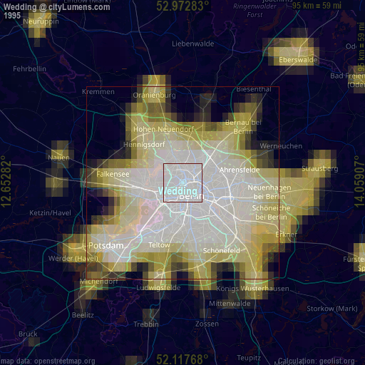
» NASA, Earths city lights 1995
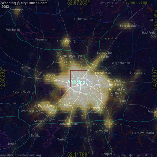
» NASA city lights 2003
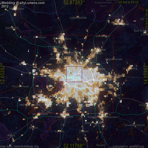
» Earth at Night: Flat Maps 2012, 2016