Vöhl night lights from space
Night Light of Vöhl (Hesse) from space (Germany) Src. Average luminocity for 10x10km area is 0.1022% and for 50x50km: 1.05%.
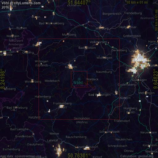
Analysis of Vöhl night lights 2016
Square area 10x10 km:
 0%
0%90-99
0%80-89
0%70-79
0%60-69
0%50-59
0%40-49
0%30-39
0%20-29
0%10-19
0%0-9
100%Square area 50x50 km:
0.18%90-99
0.18%80-89
0.05%70-79
0.1%60-69
0.16%50-59
0.21%40-49
0.11%30-39
0.18%20-29
0.19%10-19
0.09%0-9
98.52%Clear (daylight) street map image can be seen on geolist.org.
Map coordinates:
51° 38' 38.7" North, 8° 14' 31.1" East
51° 12' 20.3" North, 8° 56' 42.4" East
50° 45' 46.8" North, 9° 38' 53.6" East
Some cities around Vöhl sort by population:
• Korbach
9.3 km =5.8 mi,  327°
327°
• Frankenberg
19.2 km =11.9 mi,  211°
211°
• Bad Wildungen
15.8 km =9.8 mi,  127°
127°
• Bad Arolsen
20 km =12.4 mi,  13°
13°
• Wolfhagen
20.6 km =12.8 mi,  49°
49°
• Medebach
16.7 km =10.4 mi,  266°
266°
• Waldeck
8.2 km =5.1 mi,  89°
89°
• Naumburg
16.1 km =10 mi,  72°
72°
2816769 (p: 6,296)
Sources (retrieved 2019-11-25):
» Earth at Night: Flat Maps 2012, 2016