Storkow night lights from space
Night Light of Storkow (Brandenburg) from space (Germany) Src. Average luminocity for 10x10km area is 0.8347% and for 50x50km: 4.1425%.
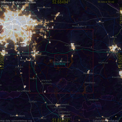
Analysis of Storkow night lights 2016
Square area 10x10 km:
 0%
0%90-99
0%80-89
0%70-79
0%60-69
0%50-59
0%40-49
0.93%30-39
0.66%20-29
0.26%10-19
0.26%0-9
97.88%Square area 50x50 km:
0.41%90-99
0.58%80-89
0.33%70-79
0.52%60-69
0.34%50-59
0.63%40-49
1.2%30-39
0.67%20-29
0.91%10-19
3.55%0-9
90.85%Clear (daylight) street map image can be seen on geolist.org.
Map coordinates:
52° 41' 5.8" North, 13° 13' 48.9" East
52° 15' 23.8" North, 13° 56' 0.1" East
51° 49' 26.9" North, 14° 38' 11.4" East
Some cities around Storkow sort by population:
• Fürstenwalde
14.5 km =9 mi,  37°
37°
• Königs Wusterhausen
21 km =13 mi,  283°
283°
• Erkner
21.9 km =13.6 mi,  326°
326°
• Zeuthen
23.5 km =14.6 mi,  295°
295°
• Beeskow
23.2 km =14.4 mi,  113°
113°
• Grünheide
20.3 km =12.6 mi,  336°
336°
• Bestensee
20.2 km =12.6 mi,  264°
264°
• Eichwalde
24.8 km =15.4 mi, 299°
2826403 (p: 9,550)
Sources (retrieved 2019-11-25):
» Earth at Night: Flat Maps 2012, 2016