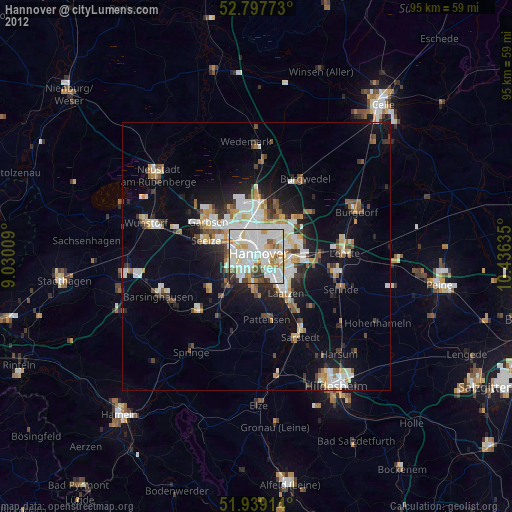
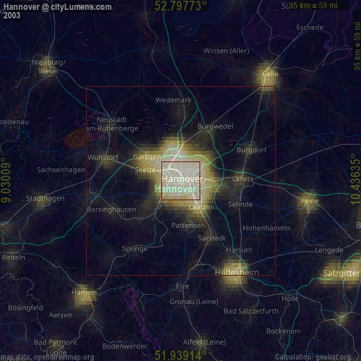
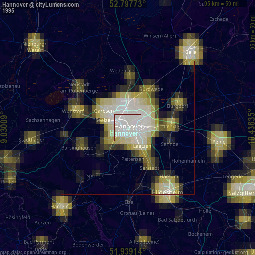
Hannover night lights from space
Night Light of Hannover (Lower Saxony) from space (Germany) Src. Average luminocity for 10x10km area is 85.2146% and for 50x50km: 13.775%.
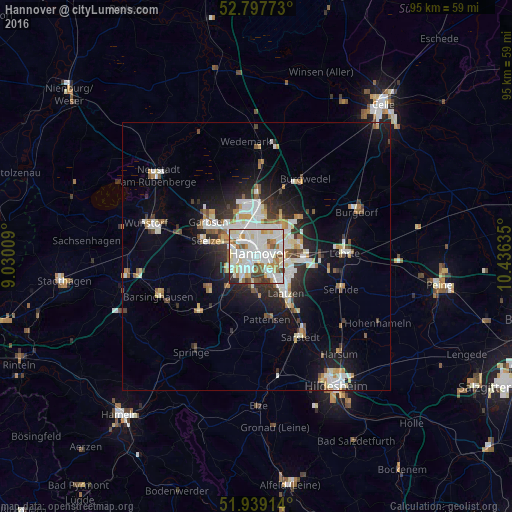
Analysis of Hannover night lights 2016
Square area 10x10 km:
 30.3%
30.3%90-99
33.33%80-89
8.33%70-79
5.43%60-69
6.82%50-59
6.19%40-49
3.91%30-39
3.16%20-29
2.53%10-19
0%0-9
0%Square area 50x50 km:
3.04%90-99
3.32%80-89
1.28%70-79
1.29%60-69
1.25%50-59
1.46%40-49
1.1%30-39
1.44%20-29
3.2%10-19
6.89%0-9
75.73%Clear (daylight) street map image can be seen on geolist.org.
Map coordinates:
52° 47' 51.8" North, 9° 1' 48.3" East
52° 22' 13.9" North, 9° 43' 59.6" East
51° 56' 20.9" North, 10° 26' 10.9" East
Some cities around Hannover sort by population:
• Garbsen
10.8 km =6.7 mi,  296°
296°
• Langenhagen
8.6 km =5.3 mi,  1°
1°
• Laatzen
7.6 km =4.7 mi,  144°
144°
• Seelze
9.7 km =6 mi,  287°
287°
• Ronnenberg
7.8 km =4.8 mi,  222°
222°
• Hemmingen
6.3 km =3.9 mi,  185°
185°
• Garbsen-Mitte
10.8 km =6.7 mi,  305°
305°
• Auf der Horst
10.4 km =6.5 mi, 301°
2910831 (p: 515,140)
Sources (retrieved 2019-11-25):
» NASA, Earths city lights 1995
» NASA city lights 2003
» Earth at Night: Flat Maps 2012, 2016