Schwalmstadt night lights from space
Night Light of Schwalmstadt (Hesse) from space (Germany) Src. Average luminocity for 10x10km area is 0.8768% and for 50x50km: 0.9437%.
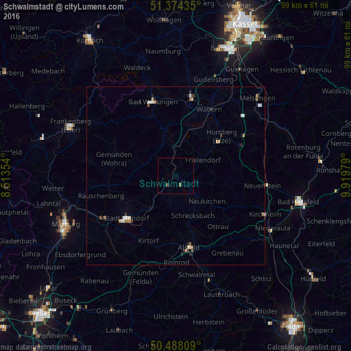
Analysis of Schwalmstadt night lights 2016
Square area 10x10 km:
 0%
0%90-99
0%80-89
0%70-79
0%60-69
0.56%50-59
0.14%40-49
0.42%30-39
0%20-29
0%10-19
0.98%0-9
97.9%Square area 50x50 km:
0.12%90-99
0.17%80-89
0.13%70-79
0.12%60-69
0.12%50-59
0.11%40-49
0.1%30-39
0.13%20-29
0.25%10-19
0.2%0-9
98.55%Clear (daylight) street map image can be seen on geolist.org.
Map coordinates:
51° 22' 27.7" North, 8° 30' 48.7" East
50° 55' 60" North, 9° 13' 0" East
50° 29' 17.1" North, 9° 55' 11.2" East
Some cities around Schwalmstadt sort by population:
• Stadtallendorf
18.9 km =11.7 mi,  229°
229°
• Alsfeld
20.5 km =12.7 mi,  169°
169°
• Homberg
16.9 km =10.5 mi,  50°
50°
• Borken
13.3 km =8.3 mi,  20°
20°
• Neustadt (Hessen)
11.6 km =7.2 mi,  217°
217°
• Frielendorf
8.5 km =5.3 mi,  60°
60°
• Neukirchen
11.6 km =7.2 mi,  128°
128°
• Willingshausen
9.3 km =5.8 mi,  187°
187°
2835345 (p: 19,279)
Sources (retrieved 2019-11-25):
» Earth at Night: Flat Maps 2012, 2016