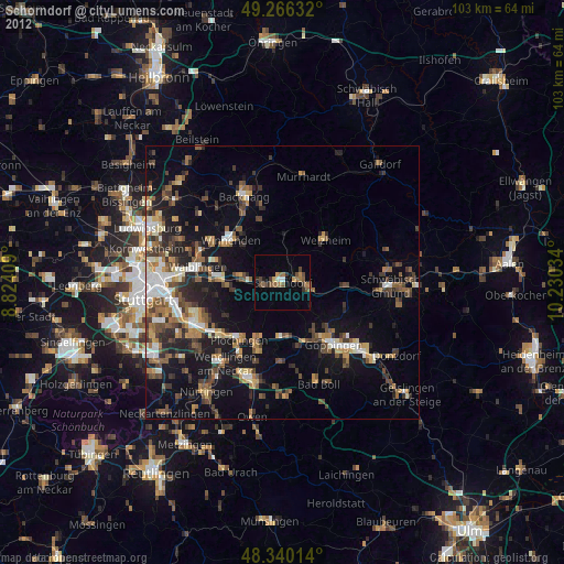
Schorndorf night lights from space
Night Light of Schorndorf (Baden-Württemberg) from space (Germany) Src. Average luminocity for 10x10km area is 15.1449% and for 50x50km: 18.4052%.
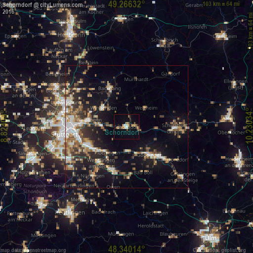
Analysis of Schorndorf night lights 2016
Square area 10x10 km:
 1.56%
1.56%90-99
1.28%80-89
0.57%70-79
3.98%60-69
0.99%50-59
3.55%40-49
1.7%30-39
0.71%20-29
3.27%10-19
3.55%0-9
78.84%Square area 50x50 km:
2.3%90-99
2.81%80-89
1.51%70-79
2.08%60-69
2.81%50-59
3.03%40-49
3.09%30-39
2.95%20-29
4.71%10-19
13.48%0-9
61.23%Clear (daylight) street map image can be seen on geolist.org.
Map coordinates:
49° 15' 58.8" North, 8° 49' 26.7" East
48° 48' 19.3" North, 9° 31' 38" East
48° 20' 24.5" North, 10° 13' 49.2" East
Some cities around Schorndorf sort by population:
• Ebersbach an der Fils
9.9 km =6.2 mi,  181°
181°
• Rudersberg
8.9 km =5.5 mi,  0°
0°
• Welzheim
11.2 km =7 mi,  44°
44°
• Plüderhausen
5.1 km =3.2 mi,  98°
98°
• Urbach
3.9 km =2.4 mi,  70°
70°
• Reichenbach an der Fils
11.6 km =7.2 mi,  203°
203°
• Winterbach
3.6 km =2.2 mi,  258°
258°
• Baltmannsweiler
9.1 km =5.7 mi,  219°
219°
2836320 (p: 39,697)
Sources (retrieved 2019-11-25):
» Earth at Night: Flat Maps 2012, 2016