Welzheim night lights from space
Night Light of Welzheim (Baden-Württemberg) from space (Germany) Src. Average luminocity for 10x10km area is 2.6321% and for 50x50km: 10.1977%.
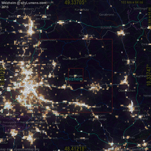
Analysis of Welzheim night lights 2016
Square area 10x10 km:
 0%
0%90-99
0%80-89
0%70-79
0.57%60-69
0.57%50-59
0.57%40-49
0.57%30-39
1.7%20-29
0%10-19
0%0-9
96.02%Square area 50x50 km:
0.92%90-99
1.1%80-89
0.78%70-79
1.32%60-69
1.42%50-59
1.48%40-49
1.83%30-39
1.5%20-29
3.26%10-19
9.58%0-9
76.8%Clear (daylight) street map image can be seen on geolist.org.
Map coordinates:
49° 20' 13.4" North, 8° 55' 52.4" East
48° 52' 36.3" North, 9° 38' 3.6" East
48° 24' 43.8" North, 10° 20' 14.9" East
Some cities around Welzheim sort by population:
• Schorndorf
11.2 km =7 mi,  224°
224°
• Murrhardt
12.6 km =7.8 mi,  338°
338°
• Rudersberg
7.7 km =4.8 mi,  276°
276°
• Lorch
9.7 km =6 mi,  154°
154°
• Plüderhausen
9.1 km =5.7 mi,  197°
197°
• Urbach
7.9 km =4.9 mi,  212°
212°
• Alfdorf
7.2 km =4.5 mi,  120°
120°
• Gschwend
10.2 km =6.3 mi,  51°
51°
2811354 (p: 11,306)
Sources (retrieved 2019-11-25):
» Earth at Night: Flat Maps 2012, 2016