Scheßlitz night lights from space
Night Light of Scheßlitz (Bavaria) from space (Germany) Src. Average luminocity for 10x10km area is 0.951% and for 50x50km: 2.9527%.
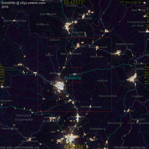
Analysis of Scheßlitz night lights 2016
Square area 10x10 km:
 0%
0%90-99
0%80-89
0%70-79
0%60-69
0%50-59
0.56%40-49
0.56%30-39
0.56%20-29
0%10-19
0%0-9
98.32%Square area 50x50 km:
0.5%90-99
0.46%80-89
0.21%70-79
0.17%60-69
0.45%50-59
0.35%40-49
0.49%30-39
0.23%20-29
0.73%10-19
2.49%0-9
93.92%Clear (daylight) street map image can be seen on geolist.org.
Map coordinates:
50° 25' 32.7" North, 10° 19' 47.5" East
49° 58' 32.4" North, 11° 1' 58.8" East
49° 31' 16.9" North, 11° 44' 10" East
Some cities around Scheßlitz sort by population:
• Bamberg
12.8 km =8 mi,  227°
227°
• Bad Staffelstein
14.2 km =8.8 mi,  350°
350°
• Memmelsdorf
7.3 km =4.5 mi, 226°
• Hallstadt
12.4 km =7.7 mi,  245°
245°
• Strullendorf
15.2 km =9.4 mi,  196°
196°
• Litzendorf
7 km =4.3 mi,  193°
193°
• Ebensfeld
11.4 km =7.1 mi,  332°
332°
• Zapfendorf
8.6 km =5.3 mi,  303°
303°
2839613 (p: 7,195)
Sources (retrieved 2019-11-25):
» Earth at Night: Flat Maps 2012, 2016