Bad Staffelstein night lights from space
Night Light of Bad Staffelstein (Bavaria) from space (Germany) Src. Average luminocity for 10x10km area is 3.1551% and for 50x50km: 3.5352%.
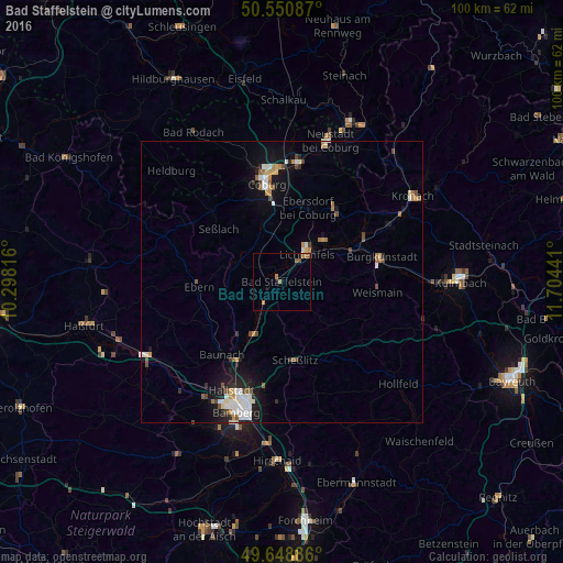
Analysis of Bad Staffelstein night lights 2016
Square area 10x10 km:
 0%
0%90-99
0%80-89
0%70-79
0.27%60-69
2.41%50-59
0.8%40-49
0.53%30-39
0%20-29
0%10-19
0.94%0-9
95.05%Square area 50x50 km:
0.59%90-99
0.66%80-89
0.3%70-79
0.33%60-69
0.47%50-59
0.46%40-49
0.52%30-39
0.14%20-29
0.63%10-19
2.49%0-9
93.41%Clear (daylight) street map image can be seen on geolist.org.
Map coordinates:
50° 33' 3.1" North, 10° 17' 53.4" East
50° 6' 7.2" North, 11° 0' 4.6" East
49° 38' 55.9" North, 11° 42' 15.9" East
Some cities around Bad Staffelstein sort by population:
• Coburg
17.7 km =11 mi,  351°
351°
• Lichtenfels
6.4 km =4 mi,  40°
40°
• Scheßlitz
14.2 km =8.8 mi,  170°
170°
• Michelau
10.4 km =6.5 mi,  49°
49°
• Ebensfeld
5 km =3.1 mi,  217°
217°
• Altenkunstadt
17.9 km =11.1 mi,  81°
81°
• Sonnefeld
15.8 km =9.8 mi, 36°
• Zapfendorf
10.6 km =6.6 mi,  207°
207°
2829701 (p: 10,618)
Sources (retrieved 2019-11-25):
» Earth at Night: Flat Maps 2012, 2016