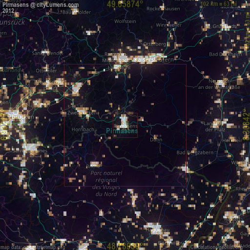
Pirmasens night lights from space
Night Light of Pirmasens (Rheinland-Pfalz) from space (Germany) Src. Average luminocity for 10x10km area is 22.2381% and for 50x50km: 5.7014%.
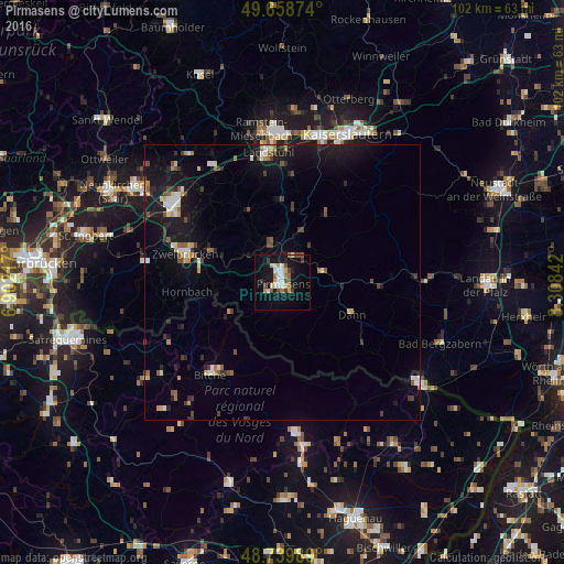
Analysis of Pirmasens night lights 2016
Square area 10x10 km:
 3.5%
3.5%90-99
4.06%80-89
2.94%70-79
1.26%60-69
2.66%50-59
2.52%40-49
3.36%30-39
1.82%20-29
2.24%10-19
24.51%0-9
51.12%Square area 50x50 km:
0.56%90-99
0.75%80-89
0.56%70-79
0.48%60-69
0.59%50-59
0.64%40-49
0.94%30-39
0.77%20-29
1.08%10-19
6.76%0-9
86.87%Clear (daylight) street map image can be seen on geolist.org.
Map coordinates:
49° 39' 31.5" North, 6° 54' 7.8" East
49° 12' 5.2" North, 7° 36' 19" East
48° 44' 23.6" North, 8° 18' 30.3" East
Some cities around Pirmasens sort by population:
• Homburg
23.8 km =14.8 mi,  305°
305°
• Zweibrücken
17.8 km =11.1 mi,  286°
286°
• Landstuhl
23.7 km =14.7 mi,  353°
353°
• Bruchmühlbach-Miesau
23.8 km =14.8 mi,  328°
328°
• Rodalben
4.9 km =3 mi,  30°
30°
• Bitche, FR
20.9 km =13 mi,  217°
217°
• Waldfischbach-Burgalben
10.1 km =6.3 mi, 26°
• Contwig
13.6 km =8.5 mi, 293°
2853574 (p: 43,582)
Sources (retrieved 2019-11-25):
» Earth at Night: Flat Maps 2012, 2016