Malente night lights from space
Night Light of Malente (Schleswig-Holstein) from space (Germany) Src. Average luminocity for 10x10km area is 3.4394% and for 50x50km: 2.0086%.
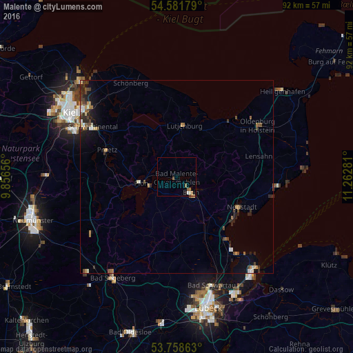
Analysis of Malente night lights 2016
Square area 10x10 km:
 0.38%
0.38%90-99
0.63%80-89
0.25%70-79
0.25%60-69
1.01%50-59
1.52%40-49
0.25%30-39
0%20-29
0.51%10-19
0%0-9
95.2%Square area 50x50 km:
0.17%90-99
0.26%80-89
0.16%70-79
0.21%60-69
0.32%50-59
0.28%40-49
0.47%30-39
0.33%20-29
0.72%10-19
1.03%0-9
96.06%Clear (daylight) street map image can be seen on geolist.org.
Map coordinates:
54° 34' 54.4" North, 9° 51' 23.6" East
54° 10' 20.1" North, 10° 33' 34.8" East
53° 45' 31.1" North, 11° 15' 46.1" East
Some cities around Malente sort by population:
• Eutin
4.7 km =2.9 mi,  138°
138°
• Neustadt in Holstein
18.1 km =11.2 mi,  113°
113°
• Preetz
19.6 km =12.2 mi,  290°
290°
• Plön
8.9 km =5.5 mi,  262°
262°
• Scharbeutz
19.8 km =12.3 mi, 141°
• Ahrensbök
18.2 km =11.3 mi,  176°
176°
• Lütjenburg
13.4 km =8.3 mi,  8°
8°
• Süsel
13.7 km =8.5 mi, 137°
2874111 (p: 10,817)
Sources (retrieved 2019-11-25):
» Earth at Night: Flat Maps 2012, 2016