Eutin night lights from space
Night Light of Eutin (Schleswig-Holstein) from space (Germany) Src. Average luminocity for 10x10km area is 4.2715% and for 50x50km: 1.9221%.
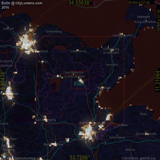
Analysis of Eutin night lights 2016
Square area 10x10 km:
 0.38%
0.38%90-99
0.63%80-89
0.51%70-79
0.38%60-69
1.14%50-59
1.52%40-49
0.51%30-39
0%20-29
0.51%10-19
0%0-9
94.44%Square area 50x50 km:
0.18%90-99
0.21%80-89
0.16%70-79
0.22%60-69
0.21%50-59
0.35%40-49
0.36%30-39
0.24%20-29
0.43%10-19
1.46%0-9
96.18%Clear (daylight) street map image can be seen on geolist.org.
Map coordinates:
54° 33' 1.4" North, 9° 54' 15.8" East
54° 8' 25.9" North, 10° 36' 27" East
53° 43' 35.8" North, 11° 18' 38.3" East
Some cities around Eutin sort by population:
• Neustadt in Holstein
14 km =8.7 mi,  105°
105°
• Plön
12.2 km =7.6 mi,  281°
281°
• Scharbeutz
15.1 km =9.4 mi,  142°
142°
• Malente
4.7 km =2.9 mi,  318°
318°
• Timmendorfer Strand
19.6 km =12.2 mi,  145°
145°
• Ahrensbök
14.8 km =9.2 mi,  188°
188°
• Lütjenburg
16.9 km =10.5 mi,  356°
356°
• Süsel
9 km =5.6 mi, 136°
2928381 (p: 16,984)
Sources (retrieved 2019-11-25):
» Earth at Night: Flat Maps 2012, 2016