Mainz night lights from space
Night Light of Mainz (Rheinland-Pfalz) from space (Germany) Src. Average luminocity for 10x10km area is 66.4986% and for 50x50km: 23.1204%.
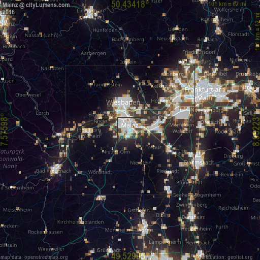
Analysis of Mainz night lights 2016
Square area 10x10 km:
 23.53%
90-99
20.59%80-89
4.2%70-79
2.8%60-69
5.6%50-59
3.92%40-49
6.3%30-39
12.61%20-29
15.13%10-19
5.32%0-9
0%Square area 50x50 km:
4.7%90-99
4.71%80-89
1.85%70-79
2.1%60-69
2.54%50-59
2.28%40-49
3.37%30-39
3.83%20-29
7.36%10-19
14.69%0-9
52.56%Clear (daylight) street map image can be seen on geolist.org.
Map coordinates:
50° 26' 3" North, 7° 34' 33.5" East
49° 59' 3.1" North, 8° 16' 44.8" East
49° 31' 47.8" North, 8° 58' 56" East
Some cities around Mainz sort by population:
• Rüsselsheim
10.3 km =6.4 mi,  86°
86°
• Hochheim am Main
6.2 km =3.9 mi,  57°
57°
• Ginsheim-Gustavsburg
5 km =3.1 mi,  107°
107°
• Bischofsheim
6.4 km =4 mi,  80°
80°
• Budenheim
8.8 km =5.5 mi,  294°
294°
• Nieder-Olm
9.6 km =6 mi,  213°
213°
• Bodenheim
6.2 km =3.9 mi,  151°
151°
• Nackenheim
8.8 km =5.5 mi, 150°
2874225 (p: 184,997)
Sources (retrieved 2019-11-25):
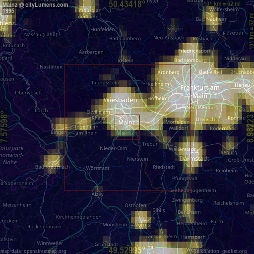
» NASA, Earths city lights 1995
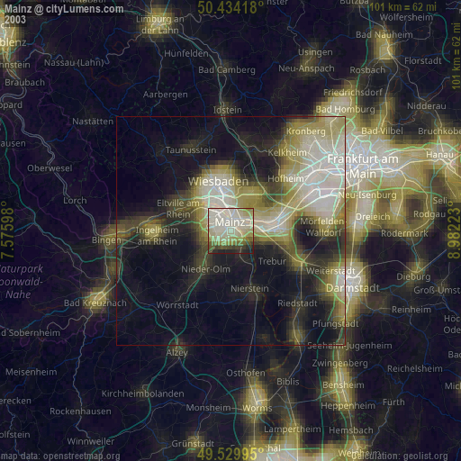
» NASA city lights 2003
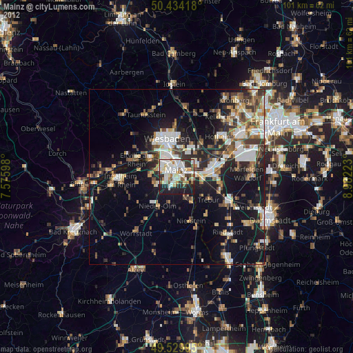
» Earth at Night: Flat Maps 2012, 2016