Lübbecke night lights from space
Night Light of Lübbecke (North Rhine-Westphalia) from space (Germany) Src. Average luminocity for 10x10km area is 0.2942% and for 50x50km: 3.1829%.
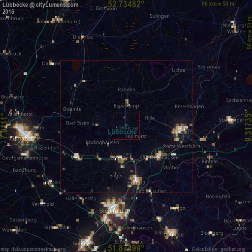
Analysis of Lübbecke night lights 2016
Square area 10x10 km:
 0%
0%90-99
0%80-89
0%70-79
0%60-69
0%50-59
0%40-49
0%30-39
0.51%20-29
0%10-19
0.51%0-9
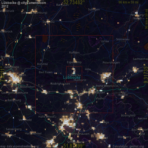
98.99%Square area 50x50 km:
0.23%90-99
0.45%80-89
0.25%70-79
0.28%60-69
0.41%50-59
0.64%40-49
0.72%30-39
0.47%20-29
0.45%10-19
1.54%0-9
94.58%Clear (daylight) street map image can be seen on geolist.org.
Map coordinates:
52° 44' 5.4" North, 7° 54' 40" East
52° 18' 25.2" North, 8° 36' 51.2" East
51° 52' 30" North, 9° 19' 2.5" East
Some cities around Lübbecke sort by population:
• Bünde
12.2 km =7.6 mi,  188°
188°
• Espelkamp
8.4 km =5.2 mi,  3°
3°
• Hille
9.7 km =6 mi,  72°
72°
• Kirchlengern
12 km =7.5 mi,  173°
173°
• Hüllhorst
4.4 km =2.7 mi,  126°
126°
• Preußisch Oldendorf
8.2 km =5.1 mi,  269°
269°
• Rödinghausen
10.9 km =6.8 mi,  234°
234°
• Obernbeck
13.2 km =8.2 mi,  152°
152°
2875626 (p: 26,310)
Sources (retrieved 2019-11-25):
» Earth at Night: Flat Maps 2012, 2016