Lohfelden night lights from space
Night Light of Lohfelden (Hesse) from space (Germany) Src. Average luminocity for 10x10km area is 32.5084% and for 50x50km: 4.8343%.
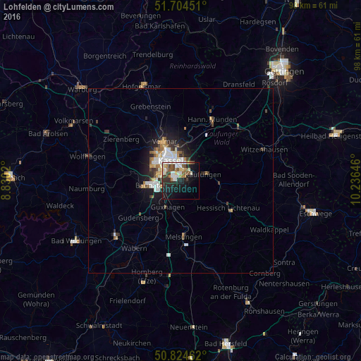
Analysis of Lohfelden night lights 2016
Square area 10x10 km:
 5.46%
5.46%90-99
7.56%80-89
2.94%70-79
2.24%60-69
4.06%50-59
5.46%40-49
3.36%30-39
4.48%20-29
10.64%10-19
21.99%0-9
31.79%Square area 50x50 km:
0.82%90-99
1.16%80-89
0.34%70-79
0.49%60-69
0.57%50-59
0.57%40-49
0.53%30-39
0.61%20-29
1.41%10-19
3.04%0-9
90.45%Clear (daylight) street map image can be seen on geolist.org.
Map coordinates:
51° 42' 16.2" North, 8° 49' 48.7" East
51° 16' 0" North, 9° 31' 60" East
50° 49' 28.6" North, 10° 14' 11.3" East
Some cities around Lohfelden sort by population:
• Kassel
6 km =3.7 mi,  337°
337°
• Baunatal
8.9 km =5.5 mi,  259°
259°
• Vellmar
10.8 km =6.7 mi, 339°
• Hessisch Lichtenau
14.9 km =9.3 mi,  120°
120°
• Kaufungen
6.1 km =3.8 mi,  74°
74°
• Fuldatal
13.2 km =8.2 mi,  10°
10°
• Helsa
10.8 km =6.7 mi,  94°
94°
• Guxhagen
8.2 km =5.1 mi,  205°
205°
2876282 (p: 13,825)
Sources (retrieved 2019-11-25):
» Earth at Night: Flat Maps 2012, 2016