Laubach night lights from space
Night Light of Laubach (Hesse) from space (Germany) Src. Average luminocity for 10x10km area is 0.3195% and for 50x50km: 2.7035%.
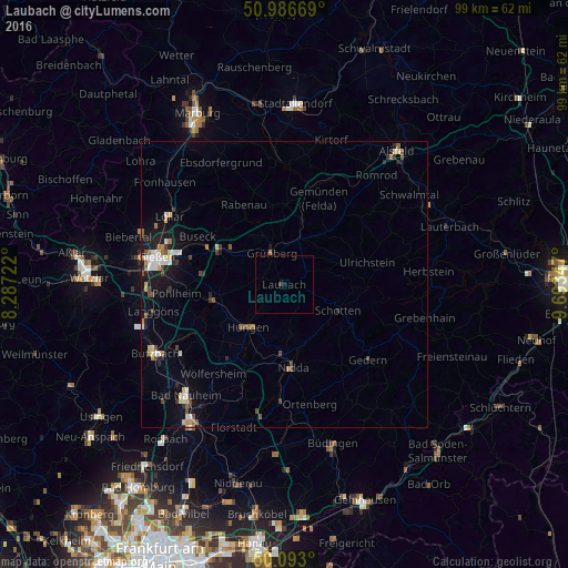
Analysis of Laubach night lights 2016
Square area 10x10 km:
 0%
0%90-99
0%80-89
0%70-79
0%60-69
0%50-59
0%40-49
0.4%30-39
0.13%20-29
0%10-19
0.4%0-9
99.06%Square area 50x50 km:
0.36%90-99
0.38%80-89
0.33%70-79
0.23%60-69
0.33%50-59
0.33%40-49
0.47%30-39
0.3%20-29
0.38%10-19
2.1%0-9
94.79%Clear (daylight) street map image can be seen on geolist.org.
Map coordinates:
50° 59' 12.1" North, 8° 17' 14" East
50° 32' 31.1" North, 8° 59' 25.2" East
50° 5' 34.8" North, 9° 41' 36.5" East
Some cities around Laubach sort by population:
• Nidda
14.4 km =8.9 mi,  175°
175°
• Grünberg
6.2 km =3.9 mi,  338°
338°
• Lich
12.6 km =7.8 mi,  259°
259°
• Schotten
10.4 km =6.5 mi,  114°
114°
• Reiskirchen
12.8 km =8 mi,  300°
300°
• Echzell
18.6 km =11.6 mi,  203°
203°
• Münzenberg
18.2 km =11.3 mi,  237°
237°
• Rabenau
17.5 km =10.9 mi,  329°
329°
2880308 (p: 10,205)
Sources (retrieved 2019-11-25):
» Earth at Night: Flat Maps 2012, 2016