Kressbronn am Bodensee night lights from space
Night Light of Kressbronn am Bodensee (Baden-Württemberg) from space (Germany) Src. Average luminocity for 10x10km area is 2.0298% and for 50x50km: 8.0802%.
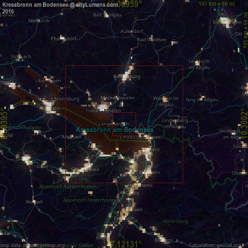
Analysis of Kressbronn am Bodensee night lights 2016
Square area 10x10 km:
 0%
0%90-99
0%80-89
0.57%70-79
0%60-69
0.28%50-59
0%40-49
0.85%30-39
0.85%20-29
0.28%10-19
0.43%0-9
96.73%Square area 50x50 km:
0.68%90-99
1.13%80-89
0.76%70-79
0.78%60-69
1.1%50-59
1.19%40-49
1.52%30-39
1.21%20-29
2.13%10-19
7.89%0-9
81.61%Clear (daylight) street map image can be seen on geolist.org.
Map coordinates:
48° 4' 10.5" North, 8° 53' 38.2" East
47° 35' 51.4" North, 9° 35' 49.5" East
47° 7' 16.7" North, 10° 18' 0.7" East
Some cities around Kressbronn am Bodensee sort by population:
• Friedrichshafen
11.2 km =7 mi,  305°
305°
• Lindau
8.7 km =5.4 mi,  131°
131°
• Tettnang
7.9 km =4.9 mi,  356°
356°
• Hard, AT
14.3 km =8.9 mi,  153°
153°
• Meckenbeuren
11.6 km =7.2 mi,  348°
348°
• Langenargen
4.2 km =2.6 mi,  271°
271°
• Hörbranz, AT
12.6 km =7.8 mi,  114°
114°
• Lochau, AT
13.5 km =8.4 mi,  121°
121°
2884344 (p: 7,834)
Sources (retrieved 2019-11-25):
» Earth at Night: Flat Maps 2012, 2016