Höchstädt an der Donau night lights from space
Night Light of Höchstädt an der Donau (Bavaria) from space (Germany) Src. Average luminocity for 10x10km area is 2.4018% and for 50x50km: 4.5937%.
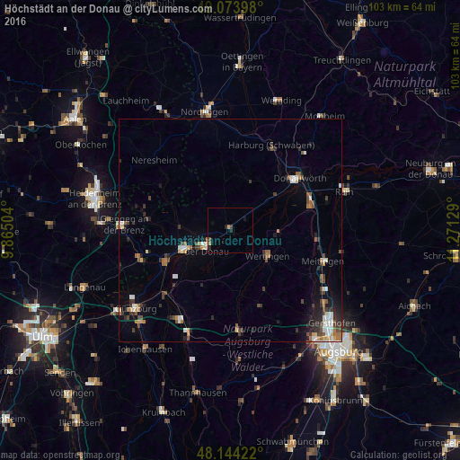
Analysis of Höchstädt an der Donau night lights 2016
Square area 10x10 km:
 0%
0%90-99
0%80-89
0%70-79
0%60-69
1.19%50-59
0.6%40-49
0%30-39
0.6%20-29
1.79%10-19
0.6%0-9
95.24%Square area 50x50 km:
0.6%90-99
0.66%80-89
0.28%70-79
0.44%60-69
0.6%50-59
0.64%40-49
0.87%30-39
0.91%20-29
1.03%10-19
1.74%0-9
92.22%Clear (daylight) street map image can be seen on geolist.org.
Map coordinates:
49° 4' 26.3" North, 9° 51' 54.1" East
48° 36' 40.5" North, 10° 34' 5.4" East
48° 8' 39.2" North, 11° 16' 16.6" East
Some cities around Höchstädt an der Donau sort by population:
• Dillingen an der Donau
6.3 km =3.9 mi,  238°
238°
• Donauwörth
19.5 km =12.1 mi,  52°
52°
• Lauingen
11.4 km =7.1 mi,  245°
245°
• Wertingen
9.9 km =6.2 mi,  122°
122°
• Gundelfingen
15.8 km =9.8 mi, 245°
• Buttenwiesen
11 km =6.8 mi,  96°
96°
• Harburg
21.4 km =13.3 mi,  24°
24°
• Sontheim an der Brenz
21.4 km =13.3 mi, 252°
2903012 (p: 6,795)
Sources (retrieved 2019-11-25):
» Earth at Night: Flat Maps 2012, 2016