Haan night lights from space
Night Light of Haan (North Rhine-Westphalia) from space (Germany) Src. Average luminocity for 10x10km area is 54.1203% and for 50x50km: 37.7576%.
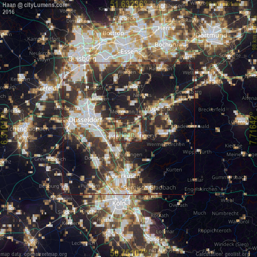
Analysis of Haan night lights 2016
Square area 10x10 km:
 4.14%
4.14%90-99
7.62%80-89
7.49%70-79
13.24%60-69
11.9%50-59
8.69%40-49
9.22%30-39
11.76%20-29
25%10-19
0.94%0-9
0%Square area 50x50 km:
6.72%90-99
7.62%80-89
3.03%70-79
4.33%60-69
4.61%50-59
5.33%40-49
5.65%30-39
8.9%20-29
12.9%10-19
18.14%0-9
22.75%Clear (daylight) street map image can be seen on geolist.org.
Map coordinates:
51° 37' 56.5" North, 6° 18' 36.6" East
51° 11' 37.8" North, 7° 0' 47.9" East
50° 45' 3.9" North, 7° 42' 59.1" East
Some cities around Haan sort by population:
• Wuppertal
11.7 km =7.3 mi,  53°
53°
• Solingen
5.5 km =3.4 mi,  114°
114°
• Langenfeld
10.5 km =6.5 mi,  205°
205°
• Hilden
6.4 km =4 mi,  243°
243°
• Erkrath
8 km =5 mi,  293°
293°
• Mettmann
6.8 km =4.2 mi,  337°
337°
• Leichlingen
9.7 km =6 mi,  177°
177°
• Wülfrath
10 km =6.2 mi,  10°
10°
2913195 (p: 29,431)
Sources (retrieved 2019-11-25):
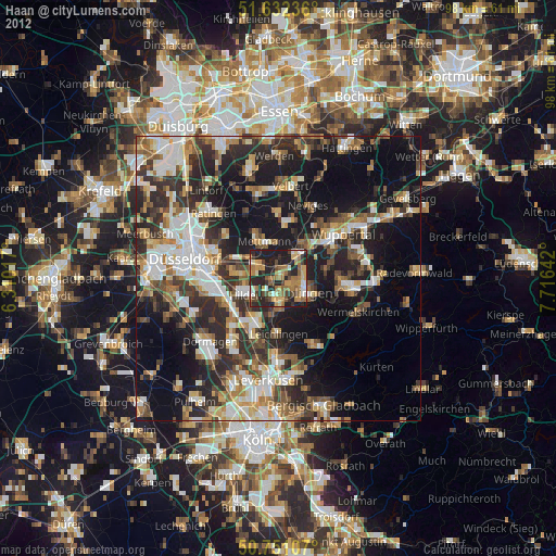
» Earth at Night: Flat Maps 2012, 2016