Großalmerode night lights from space
Night Light of Großalmerode (Hesse) from space (Germany) Src. Average luminocity for 10x10km area is 0.0098% and for 50x50km: 4.4639%.
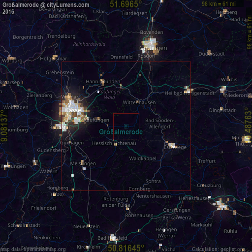
Analysis of Großalmerode night lights 2016
Square area 10x10 km:
 0%
0%90-99
0%80-89
0%70-79
0%60-69
0%50-59
0%40-49
0%30-39
0%20-29
0%10-19
0%0-9
100%Square area 50x50 km:
0.84%90-99
1.13%80-89
0.39%70-79
0.47%60-69
0.55%50-59
0.45%40-49
0.44%30-39
0.52%20-29
1.03%10-19
2.1%0-9
92.08%Clear (daylight) street map image can be seen on geolist.org.
Map coordinates:
51° 41' 47.4" North, 9° 4' 52.9" East
51° 15' 30.9" North, 9° 47' 4.2" East
50° 48' 59.2" North, 10° 29' 15.5" East
Some cities around Großalmerode sort by population:
• Witzenhausen
10.4 km =6.5 mi,  28°
28°
• Lohfelden
17.5 km =10.9 mi,  272°
272°
• Hessisch Lichtenau
8 km =5 mi,  214°
214°
• Kaufungen
11.8 km =7.3 mi,  282°
282°
• Bad Sooden-Allendorf
13.3 km =8.3 mi,  84°
84°
• Spangenberg
17.9 km =11.1 mi, 208°
• Helsa
6.7 km =4.2 mi, 271°
• Waldkappel
14.2 km =8.8 mi,  153°
153°
2917053 (p: 7,393)
Sources (retrieved 2019-11-25):
» Earth at Night: Flat Maps 2012, 2016