Gladenbach night lights from space
Night Light of Gladenbach (Hesse) from space (Germany) Src. Average luminocity for 10x10km area is 0.0784% and for 50x50km: 3.196%.
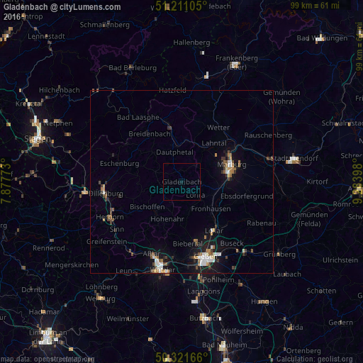
Analysis of Gladenbach night lights 2016
Square area 10x10 km:
 0%
0%90-99
0%80-89
0%70-79
0%60-69
0%50-59
0%40-49
0%30-39
0%20-29
0%10-19
0.56%0-9
99.44%Square area 50x50 km:
0.47%90-99
0.46%80-89
0.2%70-79
0.26%60-69
0.58%50-59
0.43%40-49
0.53%30-39
0.47%20-29
0.36%10-19
2.53%0-9
93.7%Clear (daylight) street map image can be seen on geolist.org.
Map coordinates:
51° 12' 39.8" North, 7° 52' 39.8" East
50° 46' 6.5" North, 8° 34' 51.1" East
50° 19' 18" North, 9° 17' 2.3" East
Some cities around Gladenbach sort by population:
• Marburg an der Lahn
14.1 km =8.8 mi,  71°
71°
• Biedenkopf
16.3 km =10.1 mi,  347°
347°
• Lollar
16.1 km =10 mi,  147°
147°
• Bad Endbach
6 km =3.7 mi,  250°
250°
• Staufenberg
15.9 km =9.9 mi,  138°
138°
• Breidenbach
15.8 km =9.8 mi,  326°
326°
• Lohra
5.4 km =3.4 mi, 136°
• Mittenaar
15.8 km =9.8 mi,  241°
241°
2920229 (p: 12,482)
Sources (retrieved 2019-11-25):
» Earth at Night: Flat Maps 2012, 2016