Freyung night lights from space
Night Light of Freyung (Bavaria) from space (Germany) Src. Average luminocity for 10x10km area is 0.5014% and for 50x50km: 0.7087%.
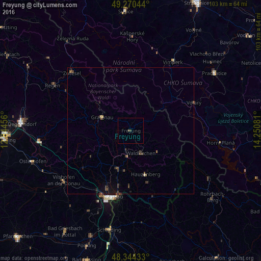
Analysis of Freyung night lights 2016
Square area 10x10 km:
 0%
0%90-99
0%80-89
0%70-79
0%60-69
0%50-59
0.28%40-49
0.28%30-39
0.57%20-29
0%10-19
0%0-9
98.86%Square area 50x50 km:
0%90-99
0.02%80-89
0.05%70-79
0.02%60-69
0.07%50-59
0.17%40-49
0.25%30-39
0.29%20-29
0.23%10-19
0.65%0-9
98.24%Clear (daylight) street map image can be seen on geolist.org.
Map coordinates:
49° 16' 13.6" North, 12° 50' 40.4" East
48° 48' 34.3" North, 13° 32' 51.6" East
48° 20' 39.6" North, 14° 15' 2.9" East
Some cities around Freyung sort by population:
• Passau
28.3 km =17.6 mi,  197°
197°
• Hauzenberg
18.7 km =11.6 mi,  162°
162°
• Waldkirchen
9.4 km =5.8 mi, 155°
• Grafenau
12.2 km =7.6 mi,  295°
295°
• Salzweg
22 km =13.7 mi,  192°
192°
• Untergriesbach
27.6 km =17.1 mi, 161°
• Hutthurm
16.2 km =10.1 mi, 200°
• Schöllnach
27.8 km =17.3 mi,  257°
257°
2924850 (p: 6,987)
Sources (retrieved 2019-11-25):
» Earth at Night: Flat Maps 2012, 2016