Deggingen night lights from space
Night Light of Deggingen (Baden-Württemberg) from space (Germany) Src. Average luminocity for 10x10km area is 1.2872% and for 50x50km: 9.5451%.
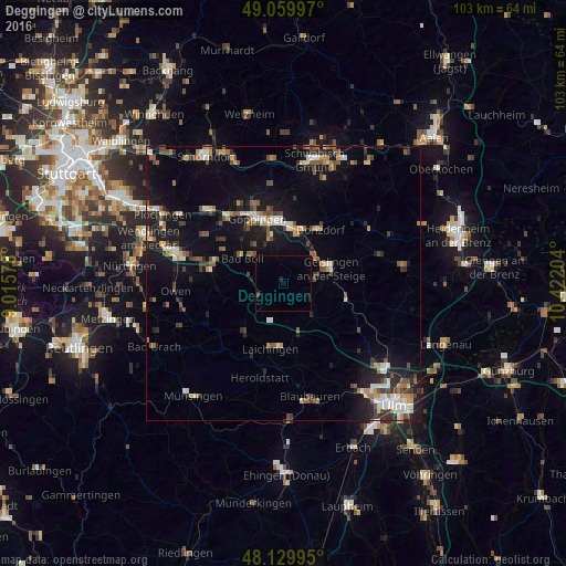
Analysis of Deggingen night lights 2016
Square area 10x10 km:
 0%
0%90-99
0%80-89
0%70-79
0%60-69
0%50-59
0%40-49
0.15%30-39
0.45%20-29
0.45%10-19
0.15%0-9
98.81%Square area 50x50 km:
1.05%90-99
1.33%80-89
0.77%70-79
1.04%60-69
1.2%50-59
1.35%40-49
1.83%30-39
1.4%20-29
2.03%10-19
8.06%0-9
79.92%Clear (daylight) street map image can be seen on geolist.org.
Map coordinates:
49° 3' 35.9" North, 9° 0' 56.8" East
48° 35' 49.6" North, 9° 43' 8.1" East
48° 7' 47.8" North, 10° 25' 19.3" East
Some cities around Deggingen sort by population:
• Geislingen an der Steige
8.5 km =5.3 mi,  69°
69°
• Eislingen
10.9 km =6.8 mi,  355°
355°
• Donzdorf
11.9 km =7.4 mi,  34°
34°
• Süßen
9.5 km =5.9 mi,  16°
16°
• Salach
10.6 km =6.6 mi,  7°
7°
• Kuchen
7.3 km =4.5 mi,  54°
54°
• Heiningen
8.8 km =5.5 mi,  324°
324°
• Boll
9.3 km =5.8 mi,  303°
303°
2938538 (p: 5,623)
Sources (retrieved 2019-11-25):
» Earth at Night: Flat Maps 2012, 2016