Donzdorf night lights from space
Night Light of Donzdorf (Baden-Württemberg) from space (Germany) Src. Average luminocity for 10x10km area is 9.2068% and for 50x50km: 7.9552%.
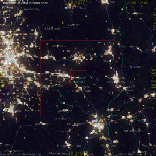
Analysis of Donzdorf night lights 2016
Square area 10x10 km:
 0%
0%90-99
0.6%80-89
0.74%70-79
2.23%60-69
1.34%50-59
1.64%40-49
1.64%30-39
0.74%20-29
0.6%10-19
3.72%0-9
86.76%Square area 50x50 km:
0.67%90-99
0.84%80-89
0.64%70-79
0.89%60-69
1.02%50-59
1.4%40-49
1.41%30-39
1.16%20-29
1.23%10-19
6.85%0-9
83.89%Clear (daylight) street map image can be seen on geolist.org.
Map coordinates:
49° 8' 51" North, 9° 6' 26.7" East
48° 41' 7.6" North, 9° 48' 37.9" East
48° 13' 8.8" North, 10° 30' 49.2" East
Some cities around Donzdorf sort by population:
• Göppingen
11.8 km =7.3 mi,  279°
279°
• Geislingen an der Steige
6.9 km =4.3 mi,  169°
169°
• Eislingen
7.7 km =4.8 mi, 278°
• Süßen
4.1 km =2.5 mi,  260°
260°
• Salach
5.4 km =3.4 mi, 277°
• Waldstetten
9 km =5.6 mi,  5°
5°
• Kuchen
5.6 km =3.5 mi,  188°
188°
• Böhmenkirch
9 km =5.6 mi,  91°
91°
2936186 (p: 11,051)
Sources (retrieved 2019-11-25):
» Earth at Night: Flat Maps 2012, 2016