Salach night lights from space
Night Light of Salach (Baden-Württemberg) from space (Germany) Src. Average luminocity for 10x10km area is 24.7842% and for 50x50km: 7.8184%.
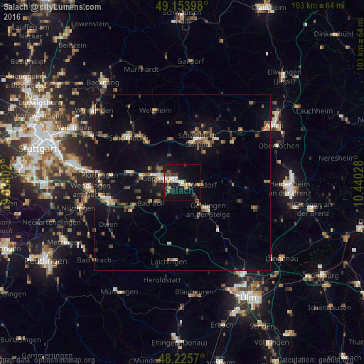
Analysis of Salach night lights 2016
Square area 10x10 km:
 3.27%
3.27%90-99
4.46%80-89
1.93%70-79
3.57%60-69
1.93%50-59
2.08%40-49
5.06%30-39
2.68%20-29
2.23%10-19
31.1%0-9
41.67%Square area 50x50 km:
0.51%90-99
0.76%80-89
0.57%70-79
0.85%60-69
1.06%50-59
1.38%40-49
1.63%30-39
1.21%20-29
1.36%10-19
7.18%0-9
83.5%Clear (daylight) street map image can be seen on geolist.org.
Map coordinates:
49° 9' 14.3" North, 9° 2' 2.5" East
48° 41' 31.1" North, 9° 44' 13.7" East
48° 13' 32.5" North, 10° 26' 25" East
Some cities around Salach sort by population:
• Göppingen
6.4 km =4 mi,  281°
281°
• Geislingen an der Steige
10 km =6.2 mi,  138°
138°
• Eislingen
2.3 km =1.4 mi, 278°
• Donzdorf
5.4 km =3.4 mi,  97°
97°
• Süßen
1.9 km =1.2 mi, 136°
• Kuchen
7.8 km =4.8 mi, 143°
• Rechberghausen
8.1 km =5 mi,  302°
302°
• Heiningen
7.2 km =4.5 mi,  242°
242°
2842331 (p: 7,778)
Sources (retrieved 2019-11-25):
» Earth at Night: Flat Maps 2012, 2016