Damme night lights from space
Night Light of Damme (Lower Saxony) from space (Germany) Src. Average luminocity for 10x10km area is 1.7487% and for 50x50km: 1.7967%.
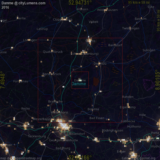
Analysis of Damme night lights 2016
Square area 10x10 km:
 0%
0%90-99
0.26%80-89
0.79%70-79
0%60-69
0%50-59
0.53%40-49
0%30-39
0.53%20-29
0.53%10-19
0%0-9
97.35%Square area 50x50 km:
0.13%90-99
0.15%80-89
0.15%70-79
0.26%60-69
0.31%50-59
0.4%40-49
0.36%30-39
0.32%20-29
0.43%10-19
1.1%0-9
96.4%Clear (daylight) street map image can be seen on geolist.org.
Map coordinates:
52° 56' 50.3" North, 7° 29' 41.3" East
52° 31' 17.7" North, 8° 11' 52.5" East
52° 5' 30" North, 8° 54' 3.8" East
Some cities around Damme sort by population:
• Lohne
16.3 km =10.1 mi,  9°
9°
• Diepholz
15.1 km =9.4 mi,  50°
50°
• Bohmte
19 km =11.8 mi,  154°
154°
• Dinklage
16.4 km =10.2 mi,  342°
342°
• Ostercappeln
19.2 km =11.9 mi,  172°
172°
• Steinfeld
7.2 km =4.5 mi, 8°
• Bersenbrück
17.2 km =10.7 mi,  281°
281°
• Holdorf
8.8 km =5.5 mi,  321°
321°
2939167 (p: 16,024)
Sources (retrieved 2019-11-25):
» Earth at Night: Flat Maps 2012, 2016