Blaubeuren night lights from space
Night Light of Blaubeuren (Baden-Württemberg) from space (Germany) Src. Average luminocity for 10x10km area is 4.1364% and for 50x50km: 6.3635%.
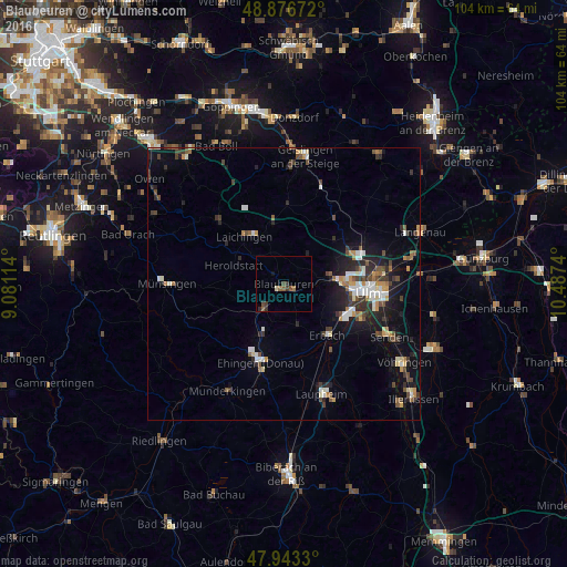
Analysis of Blaubeuren night lights 2016
Square area 10x10 km:
 0%
0%90-99
0%80-89
0.57%70-79
0%60-69
0.85%50-59
1.99%40-49
1.14%30-39
1.7%20-29
1.14%10-19
0.57%0-9
92.05%Square area 50x50 km:
0.85%90-99
0.97%80-89
0.49%70-79
0.69%60-69
0.64%50-59
0.75%40-49
1.14%30-39
1.19%20-29
1.69%10-19
4.05%0-9
87.55%Clear (daylight) street map image can be seen on geolist.org.
Map coordinates:
48° 52' 36.2" North, 9° 4' 52.1" East
48° 24' 43.7" North, 9° 47' 3.4" East
47° 56' 35.9" North, 10° 29' 14.6" East
Some cities around Blaubeuren sort by population:
• Ulm
15.4 km =9.6 mi,  95°
95°
• Neu-Ulm
16.9 km =10.5 mi, 97°
• Ehingen
15 km =9.3 mi,  196°
196°
• Klingenstein
9.2 km =5.7 mi,  85°
85°
• Erbach
12 km =7.5 mi,  140°
140°
• Laichingen
11.2 km =7 mi,  319°
319°
• Dornstadt
13.3 km =8.3 mi,  62°
62°
• Schelklingen
5.6 km =3.5 mi,  223°
223°
2947949 (p: 11,797)
Sources (retrieved 2019-11-25):
» Earth at Night: Flat Maps 2012, 2016