Biebesheim night lights from space
Night Light of Biebesheim (Hesse) from space (Germany) Src. Average luminocity for 10x10km area is 15.4398% and for 50x50km: 16.468%.
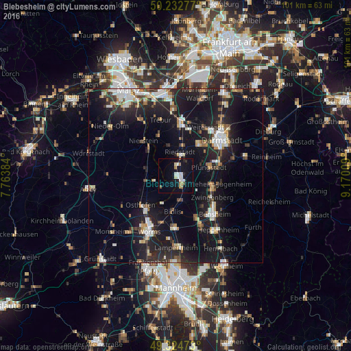
Analysis of Biebesheim night lights 2016
Square area 10x10 km:
 2.94%
2.94%90-99
2.94%80-89
1.07%70-79
1.2%60-69
2.27%50-59
1.07%40-49
0%30-39
0.53%20-29
1.34%10-19
18.45%0-9
68.18%Square area 50x50 km:
2.42%90-99
2.89%80-89
1.33%70-79
1.53%60-69
1.65%50-59
1.48%40-49
1.84%30-39
2.11%20-29
6.19%10-19
19.16%0-9
59.41%Clear (daylight) street map image can be seen on geolist.org.
Map coordinates:
50° 13' 58" North, 7° 45' 49.8" East
49° 46' 51.2" North, 8° 28' 1.1" East
49° 19' 29" North, 9° 10' 12.3" East
Some cities around Biebesheim sort by population:
• Pfungstadt
10.1 km =6.3 mi,  74°
74°
• Riedstadt
6.3 km =3.9 mi,  19°
19°
• Gernsheim
3.5 km =2.2 mi,  153°
153°
• Alsbach-Hähnlein
10.4 km =6.5 mi,  116°
116°
• Biblis
9.9 km =6.2 mi,  183°
183°
• Oppenheim
11.2 km =7 mi,  316°
316°
• Stockstadt am Rhein
3.2 km =2 mi,  7°
7°
• Bickenbach
11.1 km =6.9 mi,  102°
102°
2949240 (p: 6,626)
Sources (retrieved 2019-11-25):
» Earth at Night: Flat Maps 2012, 2016