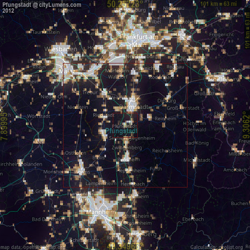
Pfungstadt night lights from space
Night Light of Pfungstadt (Hesse) from space (Germany) Src. Average luminocity for 10x10km area is 18.4225% and for 50x50km: 17.1821%.
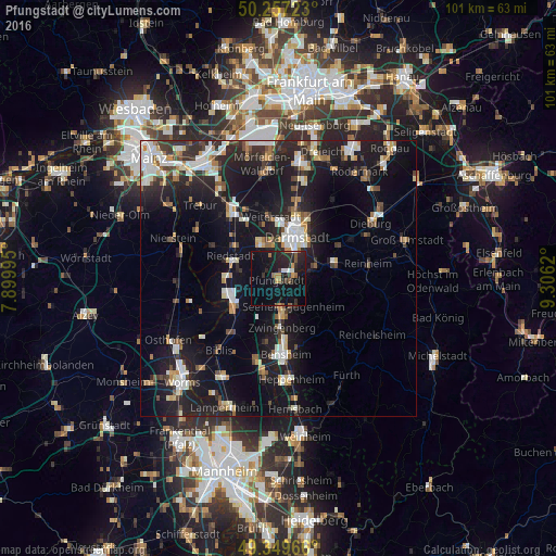
Analysis of Pfungstadt night lights 2016
Square area 10x10 km:
 1.2%
1.2%90-99
1.47%80-89
0%70-79
2.41%60-69
2.54%50-59
3.07%40-49
0.8%30-39
2.54%20-29
13.37%10-19
28.61%0-9
43.98%Square area 50x50 km:
2.68%90-99
3.13%80-89
1.53%70-79
1.49%60-69
1.8%50-59
1.57%40-49
2.07%30-39
2.08%20-29
6.36%10-19
18.09%0-9
59.2%Clear (daylight) street map image can be seen on geolist.org.
Map coordinates:
50° 15' 26" North, 7° 53' 59.8" East
49° 48' 20.1" North, 8° 36' 11.1" East
49° 20' 58.8" North, 9° 18' 22.3" East
Some cities around Pfungstadt sort by population:
• Darmstadt
8.1 km =5 mi,  24°
24°
• Griesheim
6.5 km =4 mi,  340°
340°
• Riedstadt
8.3 km =5.2 mi,  292°
292°
• Seeheim-Jugenheim
5.7 km =3.5 mi,  142°
142°
• Alsbach-Hähnlein
7.5 km =4.7 mi,  183°
183°
• Zwingenberg
9.1 km =5.7 mi, 176°
• Stockstadt am Rhein
9.4 km =5.8 mi,  272°
272°
• Bickenbach
5.3 km =3.3 mi,  168°
168°
2853924 (p: 25,084)
Sources (retrieved 2019-11-25):
» Earth at Night: Flat Maps 2012, 2016