Bernkastel-Kues night lights from space
Night Light of Bernkastel-Kues (Rheinland-Pfalz) from space (Germany) Src. Average luminocity for 10x10km area is 3.6345% and for 50x50km: 1.5792%.
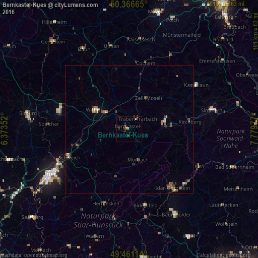
Analysis of Bernkastel-Kues night lights 2016
Square area 10x10 km:
 0%
0%90-99
0%80-89
0.84%70-79
0.28%60-69
0.56%50-59
0.84%40-49
1.12%30-39
0.84%20-29
1.68%10-19
1.12%0-9
92.72%Square area 50x50 km:
0.12%90-99
0.12%80-89
0.09%70-79
0.19%60-69
0.23%50-59
0.42%40-49
0.46%30-39
0.29%20-29
0.34%10-19
0.33%0-9
97.41%Clear (daylight) street map image can be seen on geolist.org.
Map coordinates:
50° 21' 59.9" North, 6° 22' 24.7" East
49° 54' 57.7" North, 7° 4' 35.9" East
49° 27' 40.1" North, 7° 46' 47.2" East
Some cities around Bernkastel-Kues sort by population:
• Idar-Oberstein
27.9 km =17.3 mi,  143°
143°
• Wittlich
15.3 km =9.5 mi,  300°
300°
• Morbach
12.6 km =7.8 mi,  163°
163°
• Birkenfeld
30 km =18.6 mi,  167°
167°
• Schweich
25.5 km =15.8 mi,  245°
245°
• Traben-Trarbach
4.8 km =3 mi,  35°
35°
• Hermeskeil
30.5 km =19 mi,  198°
198°
• Cochem
26.2 km =16.3 mi,  13°
13°
2949998 (p: 6,880)
Sources (retrieved 2019-11-25):
» Earth at Night: Flat Maps 2012, 2016