Bad Düben night lights from space
Night Light of Bad Düben (Saxony) from space (Germany) Src. Average luminocity for 10x10km area is 1.1404% and for 50x50km: 5.721%.
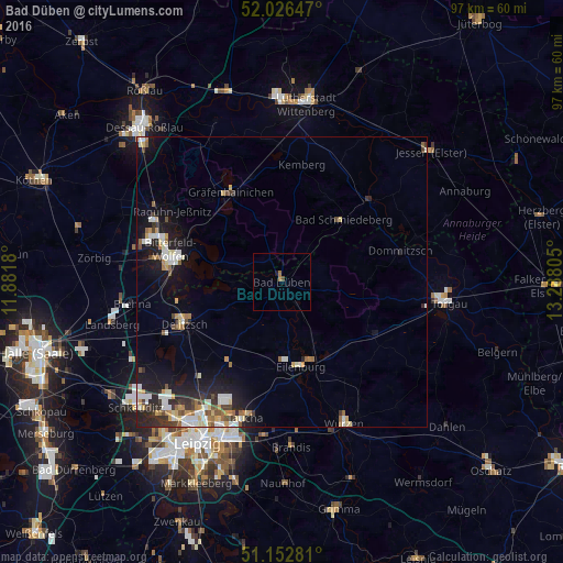
Analysis of Bad Düben night lights 2016
Square area 10x10 km:
 0%
0%90-99
0%80-89
0%70-79
0%60-69
1.07%50-59
0%40-49
0.53%30-39
0%20-29
0.27%10-19
0.27%0-9
97.86%Square area 50x50 km:
0.94%90-99
1%80-89
0.75%70-79
0.55%60-69
0.69%50-59
0.53%40-49
0.58%30-39
0.76%20-29
1.68%10-19
4.11%0-9
88.41%Clear (daylight) street map image can be seen on geolist.org.
Map coordinates:
52° 1' 35.3" North, 11° 52' 54.5" East
51° 35' 30.3" North, 12° 35' 5.7" East
51° 9' 10.1" North, 13° 17' 17" East
Some cities around Bad Düben sort by population:
• Wolfen
23.2 km =14.4 mi,  289°
289°
• Delitzsch
18.3 km =11.4 mi,  246°
246°
• Eilenburg
15 km =9.3 mi,  167°
167°
• Bitterfeld-Wolfen
18.4 km =11.4 mi,  281°
281°
• Taucha
24.2 km =15 mi,  196°
196°
• Gräfenhainichen
17.6 km =10.9 mi,  329°
329°
• Sandersdorf
22.5 km =14 mi, 280°
• Mockrehna
18.4 km =11.4 mi,  120°
120°
2953524 (p: 8,998)
Sources (retrieved 2019-11-25):
» Earth at Night: Flat Maps 2012, 2016