Esens night lights from space
Night Light of Esens (Lower Saxony) from space (Germany) Src. Average luminocity for 10x10km area is 0.2803% and for 50x50km: 0.6248%.
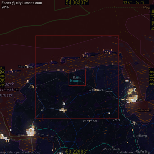
Analysis of Esens night lights 2016
Square area 10x10 km:
 0%
0%90-99
0%80-89
0%70-79
0%60-69
0%50-59
0%40-49
0%30-39
0.51%20-29
0%10-19
0.51%0-9
98.99%Square area 50x50 km:
0.05%90-99
0.09%80-89
0.04%70-79
0.04%60-69
0.04%50-59
0.17%40-49
0.15%30-39
0.2%20-29
0.15%10-19
0.1%0-9
98.96%Clear (daylight) street map image can be seen on geolist.org.
Map coordinates:
54° 3' 48.1" North, 6° 54' 34.4" East
53° 38' 55.2" North, 7° 36' 45.6" East
53° 13' 47.4" North, 8° 18' 56.9" East
Some cities around Esens sort by population:
• Aurich
21.7 km =13.5 mi,  203°
203°
• Norden
27.4 km =17 mi,  257°
257°
• Schortens
25.7 km =16 mi,  119°
119°
• Wittmund
13.5 km =8.4 mi,  126°
126°
• Jever
20.6 km =12.8 mi,  113°
113°
• Wiesmoor
27 km =16.8 mi,  162°
162°
• Friedeburg
26.5 km =16.5 mi,  146°
146°
• Hage
22.2 km =13.8 mi, 256°
2928911 (p: 6,856)
Sources (retrieved 2019-11-25):
» Earth at Night: Flat Maps 2012, 2016