Altusried night lights from space
Night Light of Altusried (Bavaria) from space (Germany) Src. Average luminocity for 10x10km area is 0.4762% and for 50x50km: 2.0946%.
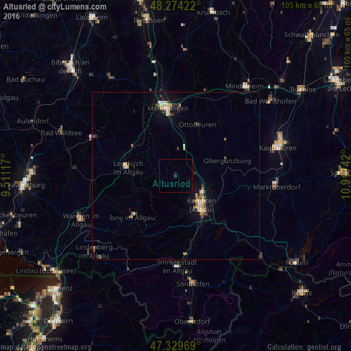
Analysis of Altusried night lights 2016
Square area 10x10 km:
 0%
0%90-99
0%80-89
0%70-79
0%60-69
0%50-59
0%40-49
0%30-39
0%20-29
0.6%10-19
0.6%0-9
98.81%Square area 50x50 km:
0.21%90-99
0.27%80-89
0.24%70-79
0.38%60-69
0.21%50-59
0.32%40-49
0.22%30-39
0.32%20-29
0.28%10-19
1.43%0-9
96.12%Clear (daylight) street map image can be seen on geolist.org.
Map coordinates:
48° 16' 27.2" North, 9° 30' 40.2" East
47° 48' 14.8" North, 10° 12' 51.4" East
47° 19' 46.9" North, 10° 55' 2.7" East
Some cities around Altusried sort by population:
• Kempten (Allgäu)
11.4 km =7.1 mi,  139°
139°
• Leutkirch
14.7 km =9.1 mi,  279°
279°
• Isny
18.1 km =11.2 mi,  226°
226°
• Waltenhofen
16.1 km =10 mi,  154°
154°
• Ottobeuren
16.5 km =10.3 mi,  22°
22°
• Dietmannsried
5.6 km =3.5 mi,  85°
85°
• Durach
15.6 km =9.7 mi, 141°
• Obergünzburg
15.9 km =9.9 mi,  73°
73°
2956787 (p: 9,950)
Sources (retrieved 2019-11-25):
» Earth at Night: Flat Maps 2012, 2016