Alheim night lights from space
Night Light of Alheim (Hesse) from space (Germany) Src. Average luminocity for 10x10km area is 0% and for 50x50km: 1.5855%.
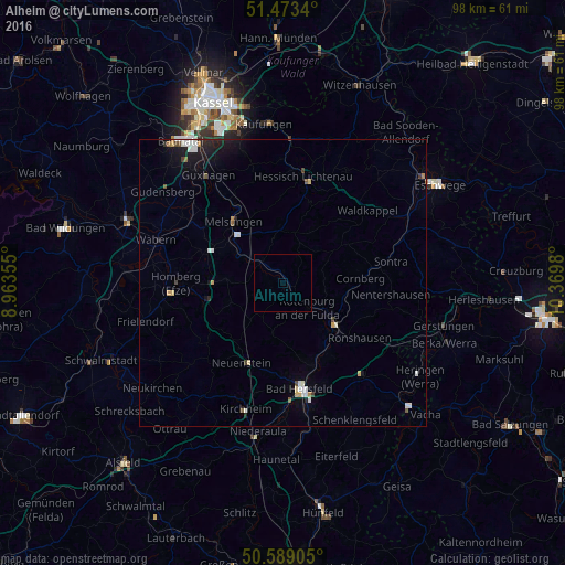
Analysis of Alheim night lights 2016
Square area 10x10 km:
 0%
0%90-99
0%80-89
0%70-79
0%60-69
0%50-59
0%40-49
0%30-39
0%20-29
0%10-19
0%0-9
100%Square area 50x50 km:
0.25%90-99
0.34%80-89
0.15%70-79
0.15%60-69
0.13%50-59
0.13%40-49
0.12%30-39
0.12%20-29
0.33%10-19
1.11%0-9
97.16%Clear (daylight) street map image can be seen on geolist.org.
Map coordinates:
51° 28' 24.2" North, 8° 57' 48.8" East
51° 1' 60" North, 9° 40' 0" East
50° 35' 20.6" North, 10° 22' 11.3" East
Some cities around Alheim sort by population:
• Bad Hersfeld
18.2 km =11.3 mi,  170°
170°
• Homberg
18.5 km =11.5 mi,  268°
268°
• Bebra
11.1 km =6.9 mi,  125°
125°
• Rotenburg an der Fulda
6 km =3.7 mi, 134°
• Melsungen
13.4 km =8.3 mi,  323°
323°
• Hessisch Lichtenau
18.8 km =11.7 mi,  11°
11°
• Spangenberg
9.2 km =5.7 mi,  358°
358°
• Waldkappel
19.2 km =11.9 mi,  49°
49°
2958494 (p: 5,292)
Sources (retrieved 2019-11-25):
» Earth at Night: Flat Maps 2012, 2016