Aichach night lights from space
Night Light of Aichach (Bavaria) from space (Germany) Src. Average luminocity for 10x10km area is 4.7273% and for 50x50km: 7.2146%.
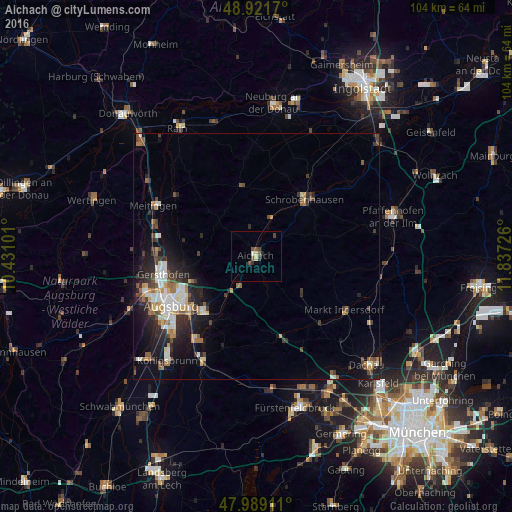

Analysis of Aichach night lights 2016
Square area 10x10 km:
 0%
0%90-99
0.28%80-89
1.42%70-79
0%60-69
0%50-59
1.85%40-49
1.99%30-39
0.85%20-29
0.85%10-19
0.14%0-9
92.61%Square area 50x50 km:
1.14%90-99
1.22%80-89
0.7%70-79
0.69%60-69
0.79%50-59
0.86%40-49
1.23%30-39
1.06%20-29
2.54%10-19
4.22%0-9
85.55%Clear (daylight) street map image can be seen on geolist.org.
Map coordinates:
48° 55' 18.1" North, 10° 25' 51.6" East
48° 27' 27.2" North, 11° 8' 2.9" East
47° 59' 20.8" North, 11° 50' 14.1" East
Some cities around Aichach sort by population:
• Friedberg
15.7 km =9.8 mi,  224°
224°
• Schrobenhausen
14.8 km =9.2 mi,  39°
39°
• Altomünster
11.9 km =7.4 mi,  130°
130°
• Pöttmes
14.5 km =9 mi,  346°
346°
• Schwabhausen
17.6 km =10.9 mi,  110°
110°
• Erdweg
18.8 km =11.7 mi,  138°
138°
• Dasing
10.3 km =6.4 mi, 218°
• Affing
11.2 km =7 mi,  275°
275°
2958975 (p: 21,042)
Sources (retrieved 2019-11-25):
» Earth at Night: Flat Maps 2012, 2016