Dasing night lights from space
Night Light of Dasing (Bavaria) from space (Germany) Src. Average luminocity for 10x10km area is 6.9503% and for 50x50km: 8.4674%.
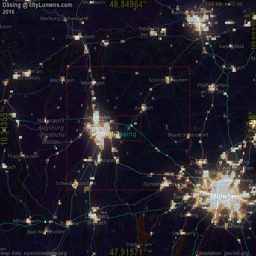
Analysis of Dasing night lights 2016
Square area 10x10 km:
 0.28%
0.28%90-99
1.42%80-89
1.14%70-79
0.57%60-69
0.99%50-59
0.71%40-49
0%30-39
1.14%20-29
2.13%10-19
4.69%0-9
86.93%Square area 50x50 km:
1.25%90-99
1.31%80-89
0.89%70-79
0.81%60-69
1.18%50-59
0.93%40-49
1.29%30-39
1.32%20-29
2.77%10-19
5.88%0-9
82.38%Clear (daylight) street map image can be seen on geolist.org.
Map coordinates:
48° 50' 58.7" North, 10° 20' 36.8" East
48° 23' 5.4" North, 11° 2' 48" East
47° 54' 56.6" North, 11° 44' 59.3" East
Some cities around Dasing sort by population:
• Augsburg
11 km =6.8 mi,  262°
262°
• Friedberg
5.5 km =3.4 mi,  235°
235°
• Aichach
10.3 km =6.4 mi,  38°
38°
• Gersthofen
13.6 km =8.5 mi,  288°
288°
• Stadtbergen
14.9 km =9.3 mi, 262°
• Mering
14 km =8.7 mi,  199°
199°
• Kissing
10.6 km =6.6 mi,  211°
211°
• Affing
10.2 km =6.3 mi,  332°
332°
2938837 (p: 5,321)
Sources (retrieved 2019-11-25):
» Earth at Night: Flat Maps 2012, 2016