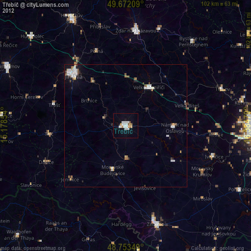
Třebíč night lights from space
Night Light of Třebíč (Vysočina) from space (Czech Republic) Src. Average luminocity for 10x10km area is 16.111% and for 50x50km: 2.5673%.
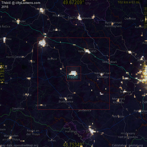
Analysis of Třebíč night lights 2016
Square area 10x10 km:
 4.28%
4.28%90-99
5.61%80-89
0.27%70-79
0.53%60-69
0.53%50-59
0.8%40-49
0.27%30-39
0.53%20-29
0%10-19
14.57%0-9
72.59%Square area 50x50 km:
0.6%90-99
0.59%80-89
0.12%70-79
0.16%60-69
0.17%50-59
0.26%40-49
0.25%30-39
0.23%20-29
0.33%10-19
1.66%0-9
95.63%Clear (daylight) street map image can be seen on geolist.org.
Map coordinates:
49° 40' 19.5" North, 15° 10' 42.7" East
49° 12' 53.7" North, 15° 52' 54" East
48° 45' 12.6" North, 16° 35' 5.2" East
Some cities around Třebíč sort by population:
• Jihlava
29.1 km =18.1 mi,  313°
313°
• Velké Meziříčí
18.2 km =11.3 mi,  31°
31°
• Moravské Budějovice
18.9 km =11.7 mi,  196°
196°
• Dačice
35.6 km =22.1 mi,  245°
245°
• Třešť
30.2 km =18.8 mi,  286°
286°
• Telč
31.3 km =19.4 mi,  263°
263°
• Náměšť nad Oslavou
20.1 km =12.5 mi,  92°
92°
• Polná
32.5 km =20.2 mi,  338°
338°
3064104 (p: 38,785)
Sources (retrieved 2019-11-25):
» Earth at Night: Flat Maps 2012, 2016